
If you’re looking for a hike that gets you off Hong Kong Island, check out the Mui Wo to the Big Buddha hike: a challenging, yet incredibly rewarding hike that takes you through sections 1 – 3 of the Lantau Trail. While it’s easy enough to get to if you’re living near Central, the hike itself can be quite difficult. That being said, the stunning views of the surrounding country parks, rolling hills, and crystal blue water make this hike well worth the effort. What’s more, you’ll end up at the Big Buddha and Po Lin Monastery where you can grab some food and drink, and, if you’re feeling up to it, play tourist for a few hours before heading back home.
Getting to the starting point of the Mui Wo to Big Buddha hike:
Head to the Central Ferry Pier and hop on the ferry to Mui Wo (I would recommend catching the 7:40 am ferry on Saturday or the 8:00 am ferry on Sunday) at pier 6. The journey takes about 40 minutes and once you get off the ferry, you’ll see a bus terminal directly in front of you, an obscene number of bicycles to your right and a McDonald’s to your left. Go right down the walkway and past the bicycles until you reach a roundabout on your left side (literally a 2-minute walk from the ferry pier). This is where you’ll begin the hike.
Lantau Trail Section 1 (Mui Wo Ferry Pier to Nam Shan; 2.5 km):
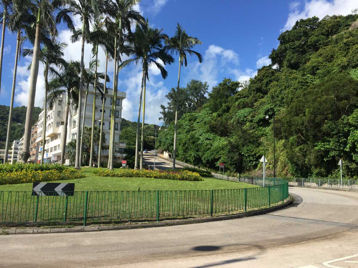
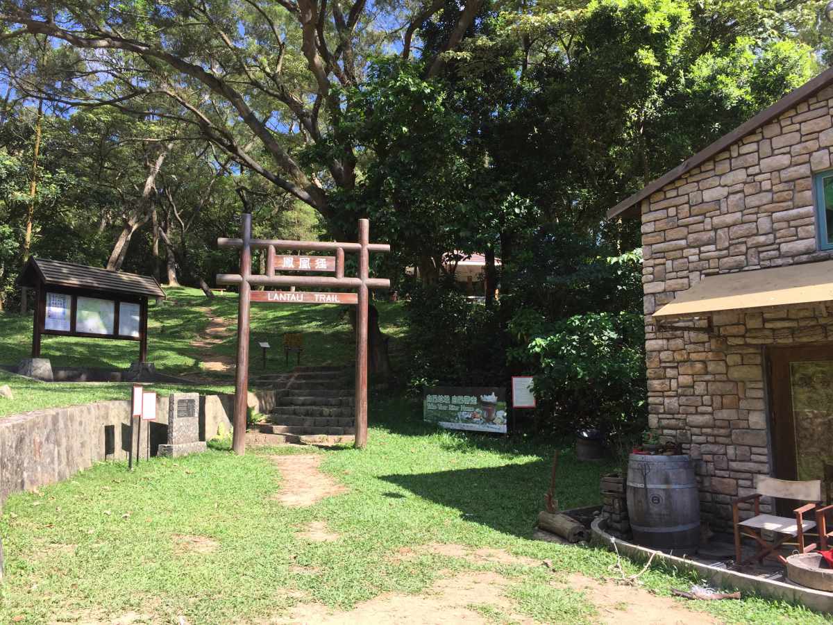
Cross the street at the roundabout and head up the sidewalk on the hill (in the first photo, you can see the sidewalk on the right of the big white building). You’ll be walking up this sidewalk for about 20 minutes until you reach a little house with plenty of greenery surrounding it and a large wooden sign that reads, “Lantau Trail” (see photo above).
Follow the path that says “South Lantau Road” (there will be signs along the way). You’ll cross a massive circular paved area (perhaps a helipad?) and might feel lost, but fret not – you’re going the right way.
Lantau Trail Section 2 (Nam Shan to Pak Kung Au; 6.5 km):
As you walk along, you’ll see the signage change from “South Lantau Road” to “Lantau Trail” or “Sunset Peak”, which is where Lantau Trail Section 2 begins. Keep following those signs.
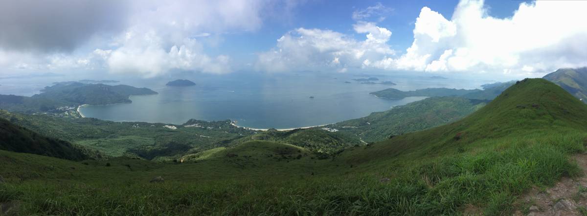
Once you are are on the top of the first elevation, you’ll be surrounded by plenty of lush green hills and the beautiful blue water. Keep following the path and shortly after you’ll come across a small waterfall on your left – perfect for wetting a towel and throwing it around your neck.
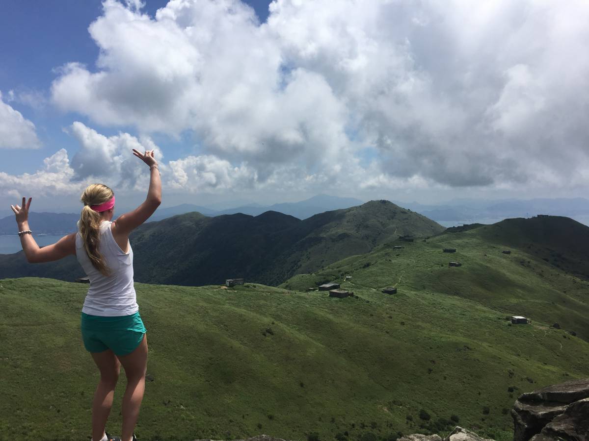
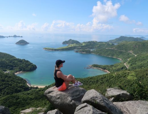
The first “picture-worthy” spot (see photo above) hugs a mountain, right before you turn right around it. There will be a relatively large open space where you’ll likely see other hikers taking photos or stopping for a quick break. Once you’re done, keep walking along the “Pak Kung Au” path.
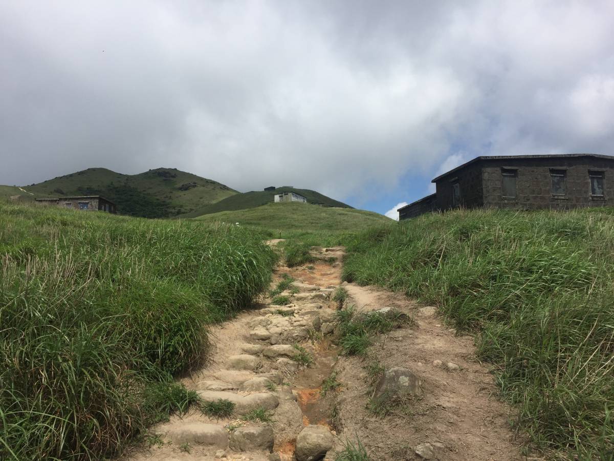
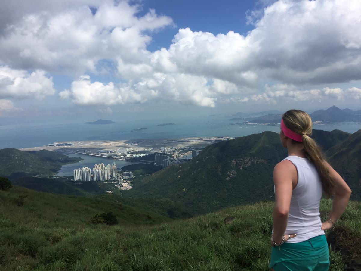
Not too long down the dirt path, you’ll see a handful of little numbered buildings scattered up on a hill that you will walk by (anyone know what these are?) There is one on the left side where you can walk behind and see the Hong Kong airport quite clearly (see photo above).
At this point, you’ll be heading up and over Sunset Peak and down to Pak Kung Au, with sweeping views of the water and surrounding country park. You’ll know you’ve reach the end of Lantau Trail Section 2 when you finally see a little gazebo. At this point, you can either choose to stop the hike if you’re feeling too tired and just grab a bus to Tung Chung MTR (there is a bus stop right on the road). Or, you can keep going and move on to Section 3 of the Lantau Trail. Either way, head down the stairs to the left of the gazebo, which will bring you to the road.
Lantau Trail Section 3 (Pak Kung Au to Ngong Ping [Big Buddha]; 4.5 km):
To start Section 3, cross the road and you’ll see a set of stairs going up to your right with the sign “Ngong Ping via Lantau Peak” – as long as you follow the signs marked with either name, you won’t take a wrong turn.
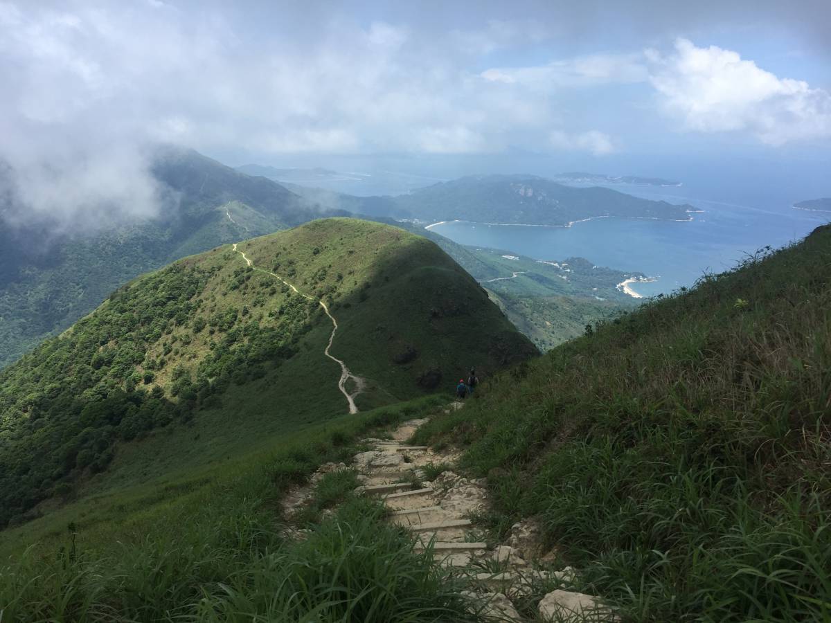
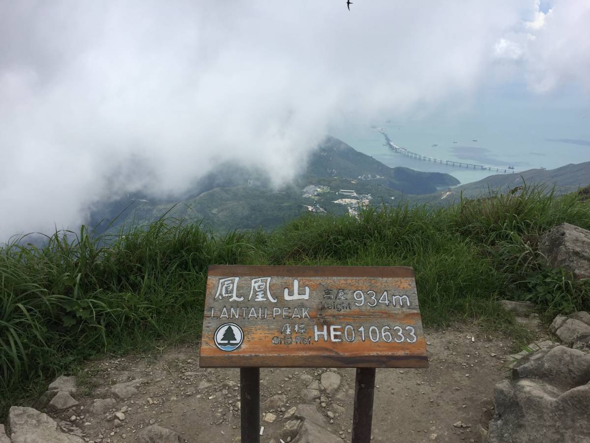
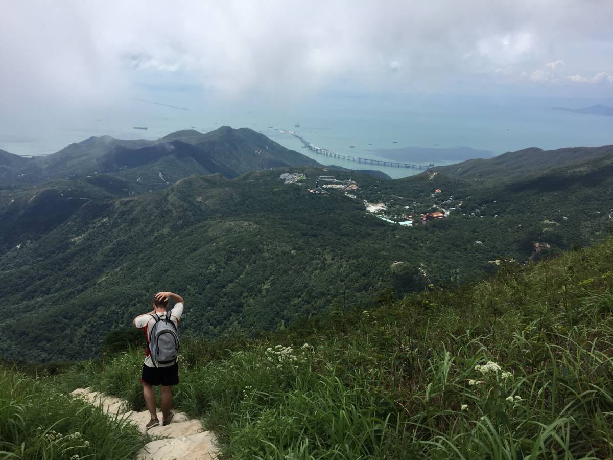
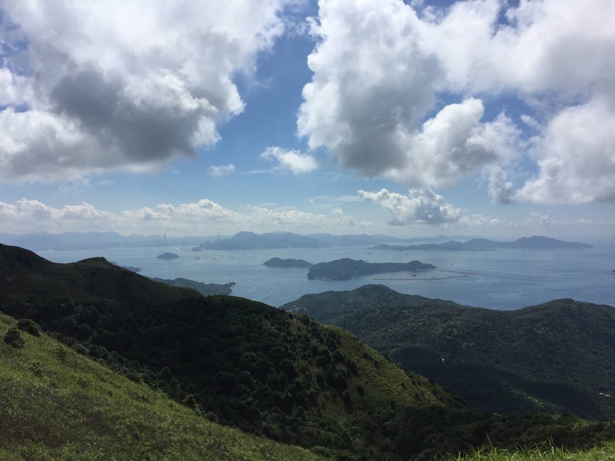
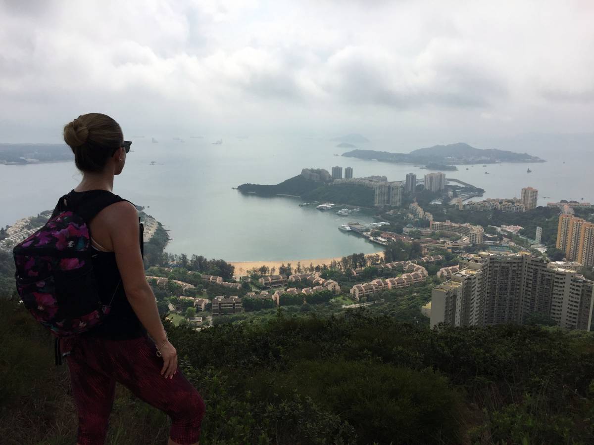
As you continue along the trail, you’ll see a massive peak (Lantau Peak) in front of you, likely with clouds surrounding the top. You’ll be hiking up to the top of the peak where you’ll be able to see The Big Buddha and Po Lin Monastery in the distance (see photo above) if the weather cooperates. The area at the top is quite cool – there’s a weather shelter there and plenty of large rocks scattered about with a 360 view. From this point on, it’s only a matter of a few hundred steps down until you reach the finish line.
When you see a bunch of tall wooden panels poking out of the trees, you’ll know you’ve almost finished the Mui Wo to the Big Buddha hike. From the Wisdom Path, it’s only a 5 minute walk to the Big Buddha and Po Lin Monastery. Once finished, hop on Bus 2, which will take you to Tung Chung MTR Station.
Journey Length: 13.5 km
Total Time: About 3.5 – 4.5 hours
Although there are many ways to get lost in this beautiful nature, if this is not your intention, my recommendation is to use a compass watch that will help you find the right way!
Lloyd
March 15, 2017 at 7:31 pmHi,
Just to say thanks very much for posting these pictures and details of the walk. I have followed it all exactly today, it was fantastic had such a great time, am exhausted now! Even though it was cloudy still got some amazing views, will look at doing some of your other adventures!
Thanks
Lloyd – from London, UK on holiday here for 9 days! 😀
thisgirlabroad
March 16, 2017 at 7:25 amHi Lloyd,
Thanks for taking the time to leave a comment. So glad this hiking guide helped and you had a great time! Enjoy the rest of your stay in HK! 🙂
Yusuf
March 23, 2017 at 2:48 pmHey,
Thanks for preparing this great guide. I am thinking of doing this trail next week.
How about the reverse route starting from Big Buddha to Mui Wo? Which one do you recommend for a tourist?
So excited!
thisgirlabroad
March 23, 2017 at 5:11 pmHi Yusuf,
Glad you’ve found it useful! Hmm, I’m honestly not sure about the reverse route, though that might be smarter since you’ll have a chance to appreciate the Big Buddha a bit more instead of getting there when you’re absolutely exhausted. Happy hiking!
Colin Messent
November 30, 2017 at 2:55 pmThe buildings you see at Sunset peak were originally retreats for missionaries on leave from China. When we lived in HK in the late 80s you could rent them during the summer. No power. During the summer the place was full of kids running around. There used to be a dam on a stream which supplied water for the houses and was a swim hole plus a haunt of frogs
thisgirlabroad
December 1, 2017 at 7:31 amHi Colin,
Wow – that’s so interesting. I had no idea! Must have been ridiculously hot there in the summer though!
Can’t imagine the change you’ve seen in HK over the years!
Colin Messent
December 1, 2017 at 3:06 pmActually it was cool compared with the Island. During the school holidays in July and August all the huts were full with families and lots of kids just having fun. I shall revisit as I will be in HK next August and plan to re-live the walk from Mui Wo to Sunset Peak and then maybe Po Lin.
thisgirlabroad
December 1, 2017 at 3:20 pmInteresting!
A walk down memory lane.. sounds so nice! 🙂
Rebecca Ferguson
March 31, 2018 at 10:03 pmThanks for this. We only had time to do part of the walk, but your description and directions were really helpful.
thisgirlabroad
March 31, 2018 at 10:07 pmGlad to hear you enjoyed it! Hopefully you’ll get a chance to do the whole thing at some point! 🙂