
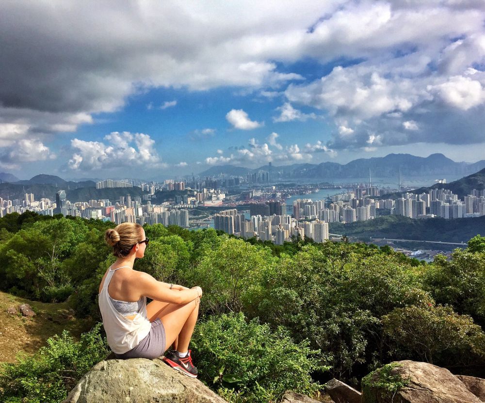
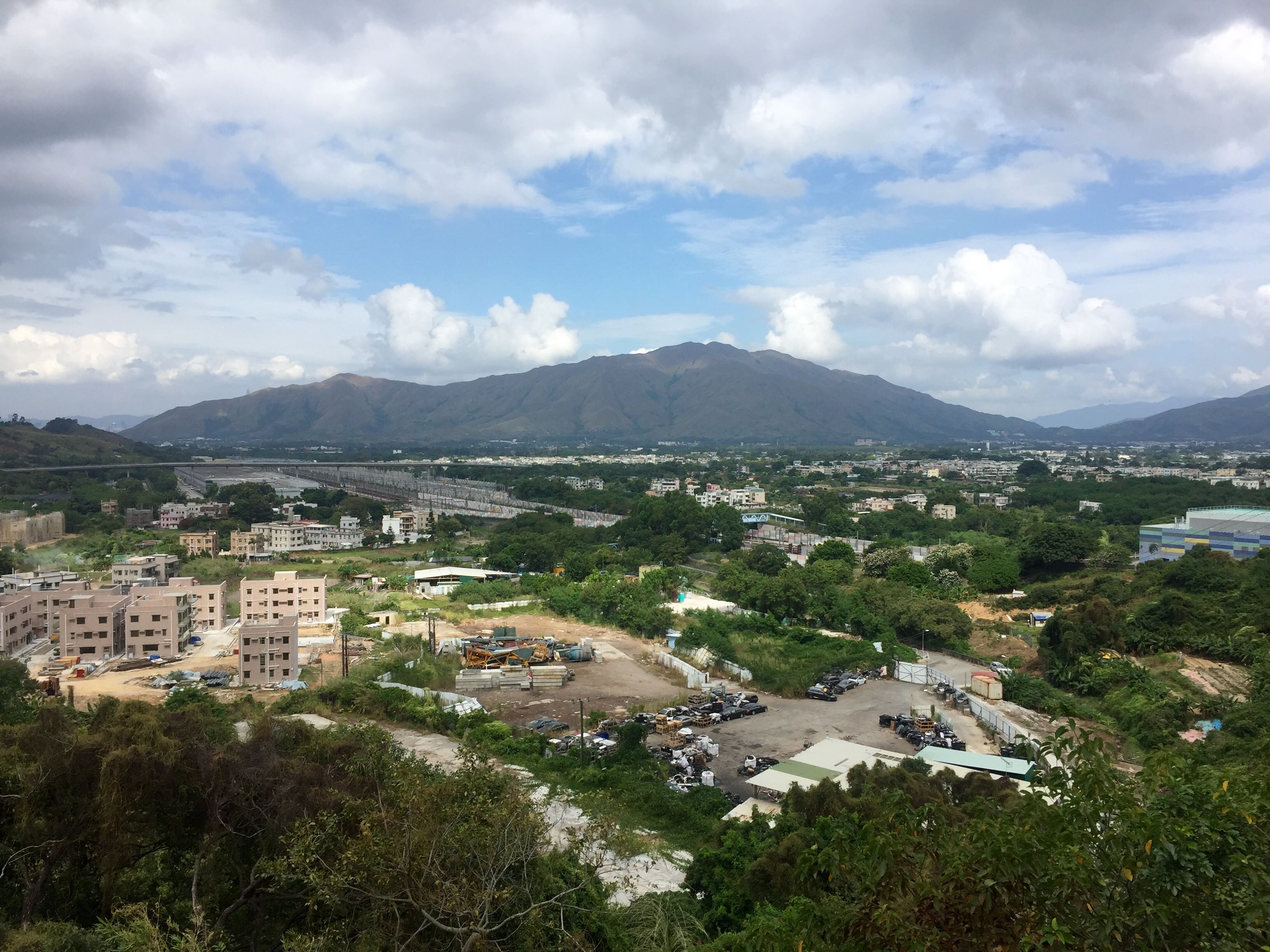
With the weather in Hong Kong cooling down, this is the perfect time of year to pull your sneakers on, and head out on a hike to explore the lesser known parts and take in some sky-high views of the city. If you’ve already done most of the popular hikes like Dragon’s Back, Lion Rock, and Twin Peaks, and are looking for something a bit different, this is the perfect hike for you; from Tai Lam Country Park to Tseun Wan with – I kid you not – the most incredible views at Shek Lung Kung. This hike is easy to get to and get home from, takes you past some interesting villages and abandoned buildings, will make for quite the adventure as you wander off the beaten track, and the view at the top is seriously wow-worthy.
Getting There
Hop on Citybus 969, which starts in Causeway Bay, and get off at Tai Lam Tunnel Toll Plaza where it will look like you’re in the middle of nowhere (you are). Walk behind the bus station and make your way right down the sidewalk. Keep walking and turn right on Pat Heung Road when the sidewalk ends. Shortly after you’ll go under a bridge – stay to the left on the walk path. You will then come across a roundabout – follow the sidewalk to your left and go around until you reach the second road (Kam Ho Road). Head up the road for about 200 steps until you make the first right along a smaller unmarked road.
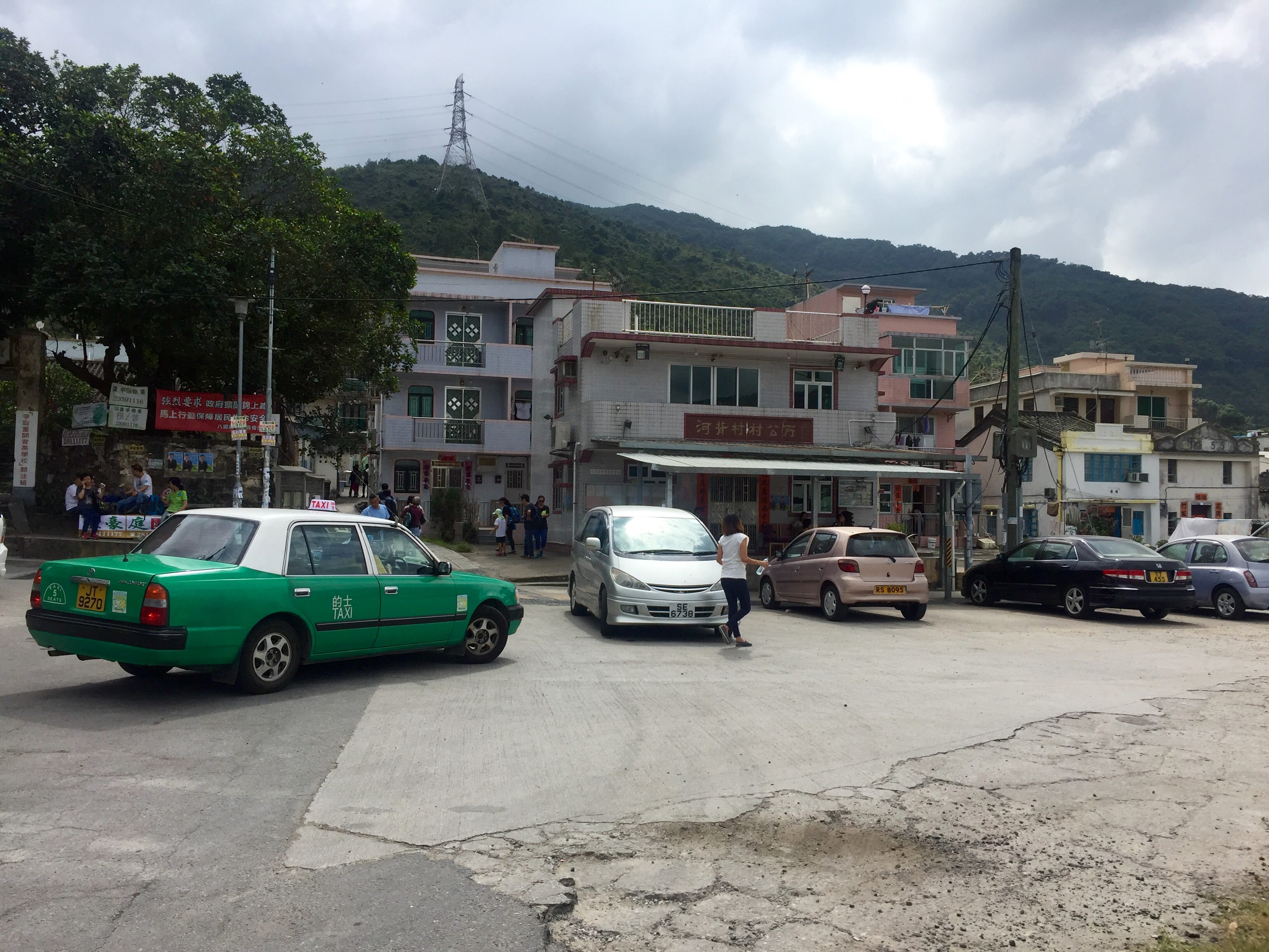
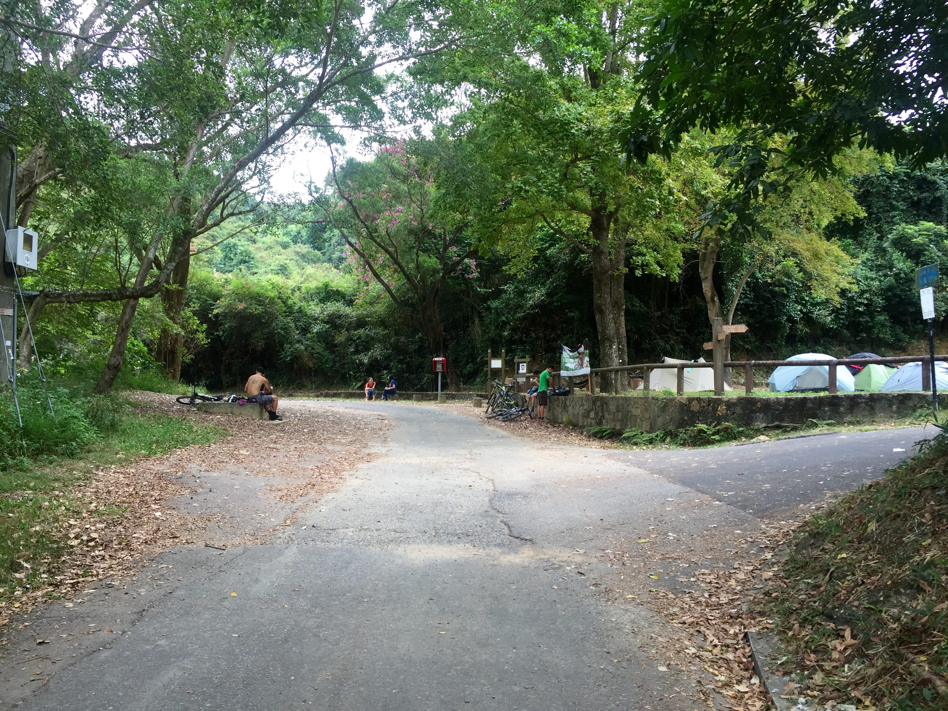
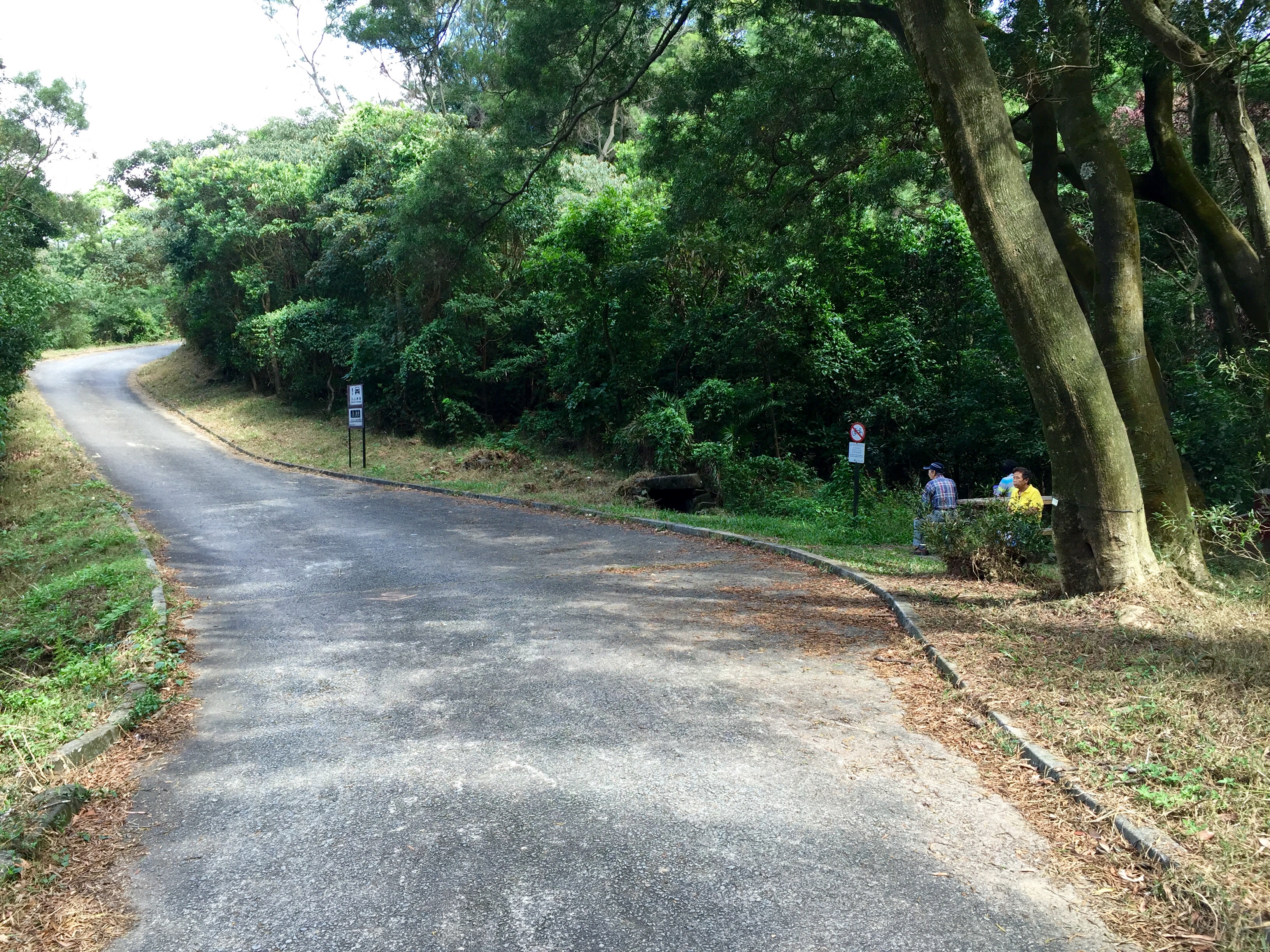
This smaller road will take you into a village, where you will continue walking down until you come to the main part of the town, just after a large parking lot, and you cannot go any further (picture below).
Start of Hike
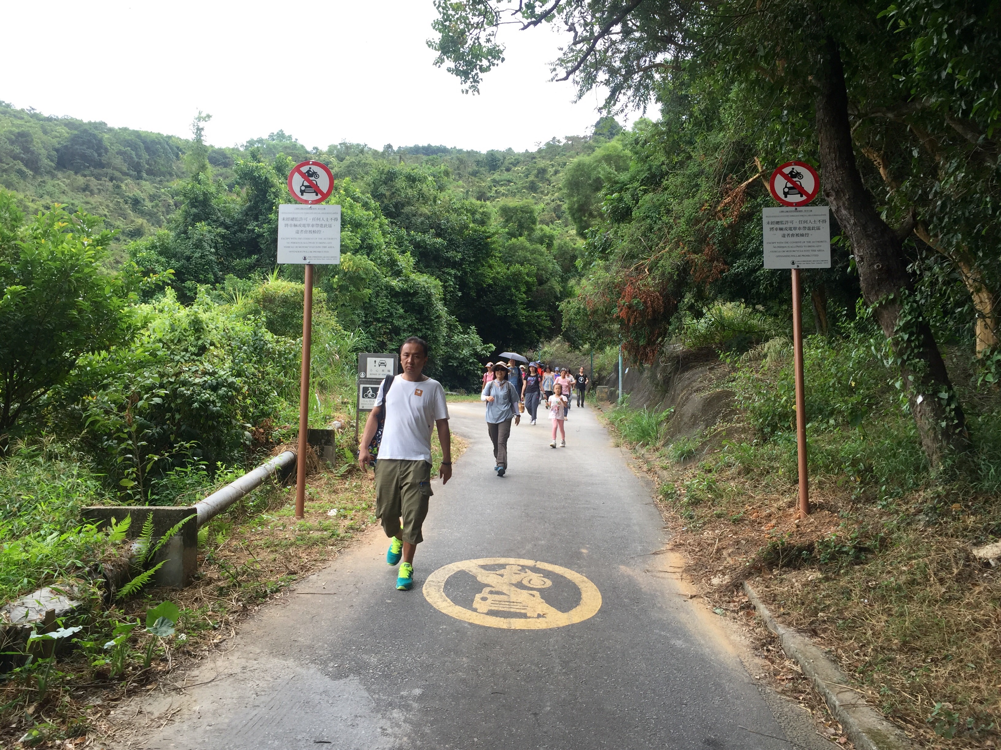
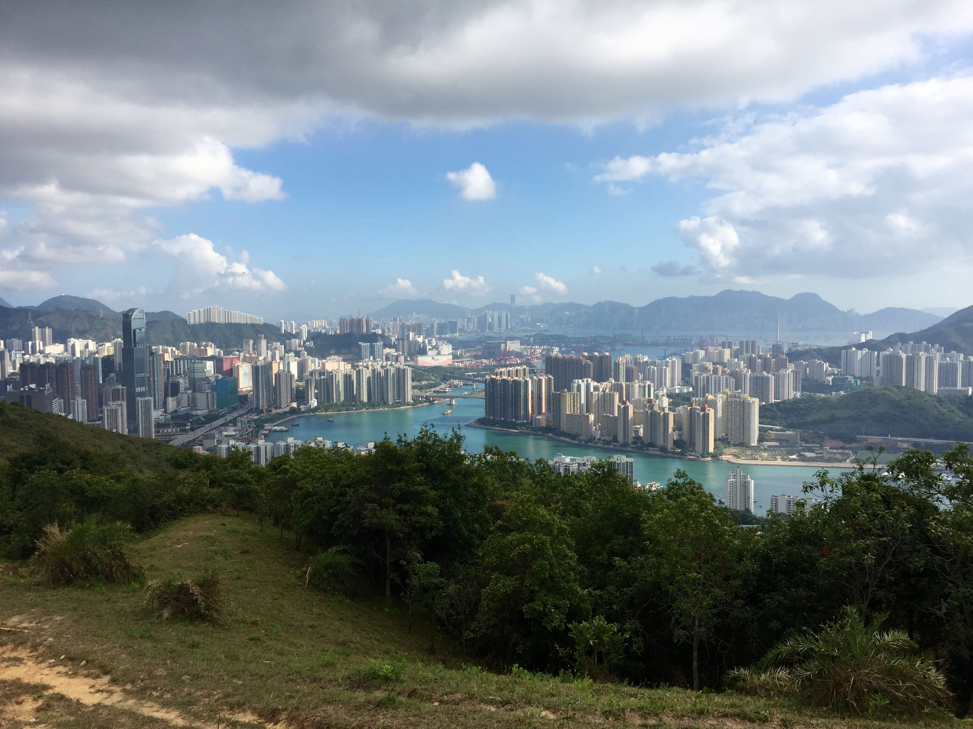
You’re then going to turn left on the first street as you walk in (in the photo above, you’re turning left before the group of people sitting on the picnic table with all the signs above them – left corner). Continue down this path until you are at a fork in the road. There will be a small yellow sign in front of you – head left towards the HKFYG Organic Farm. Follow the path up the hill (see first photo below). After about 5 – 10 minutes, there will be a few nice views of the little village on your left side (see second photo below).
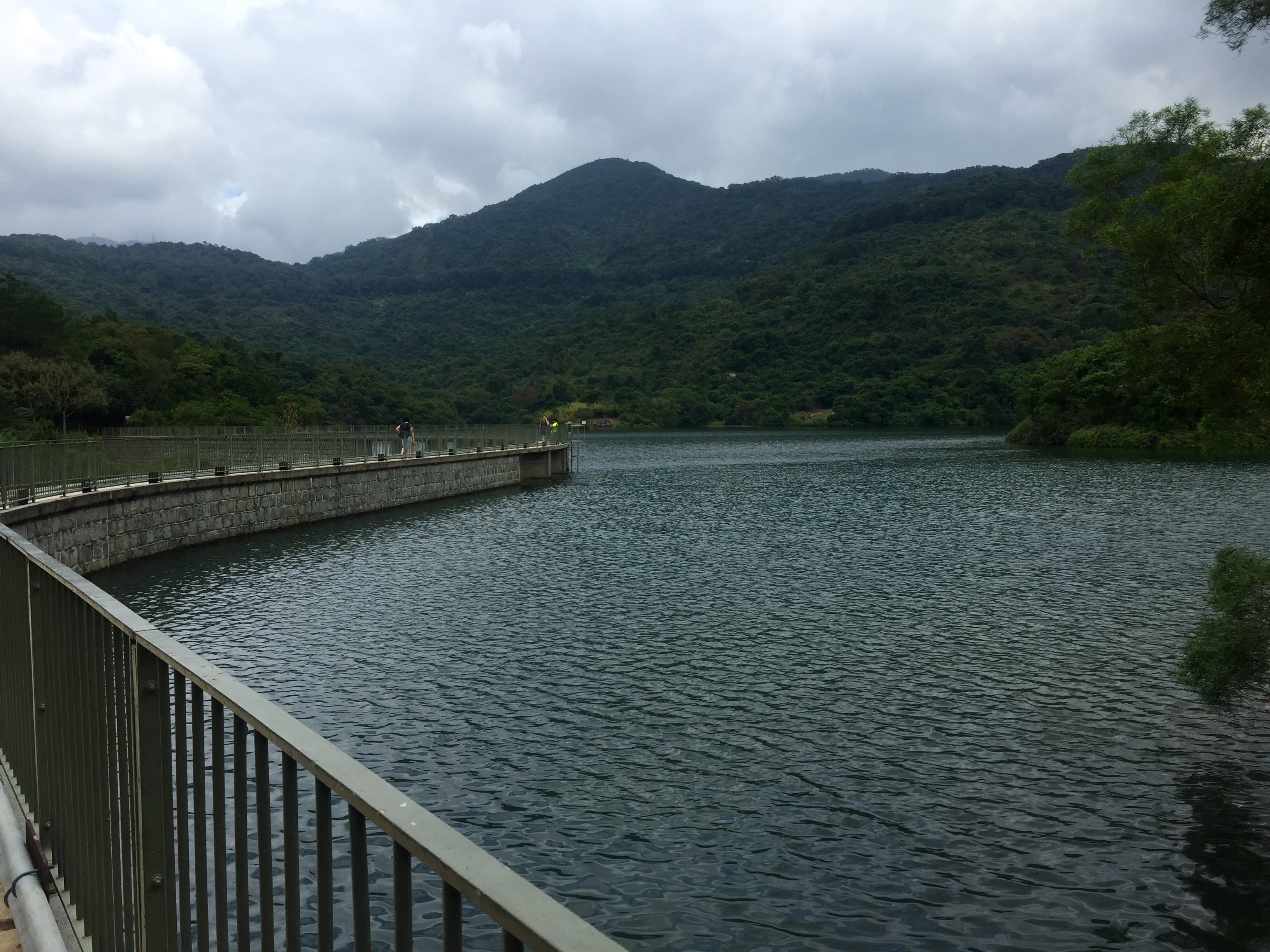
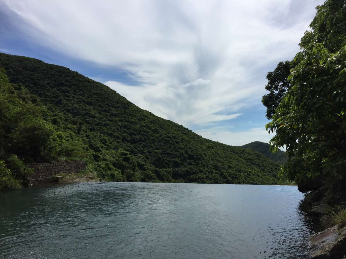
After another 10 minutes or so, you’ll come to a fork in the road – turn right and walk up (see first photo below). About 5 minutes up, you’ll pass the HKFYG Organic Farm, and after another 5 minutes, you’ll be at the top where there’s a sitting area and a large reservoir with a “bridge” going through it on your left (see second photo below). Walk along the bridge to the other side.
The Part Where You’ll Likely Feel Lost
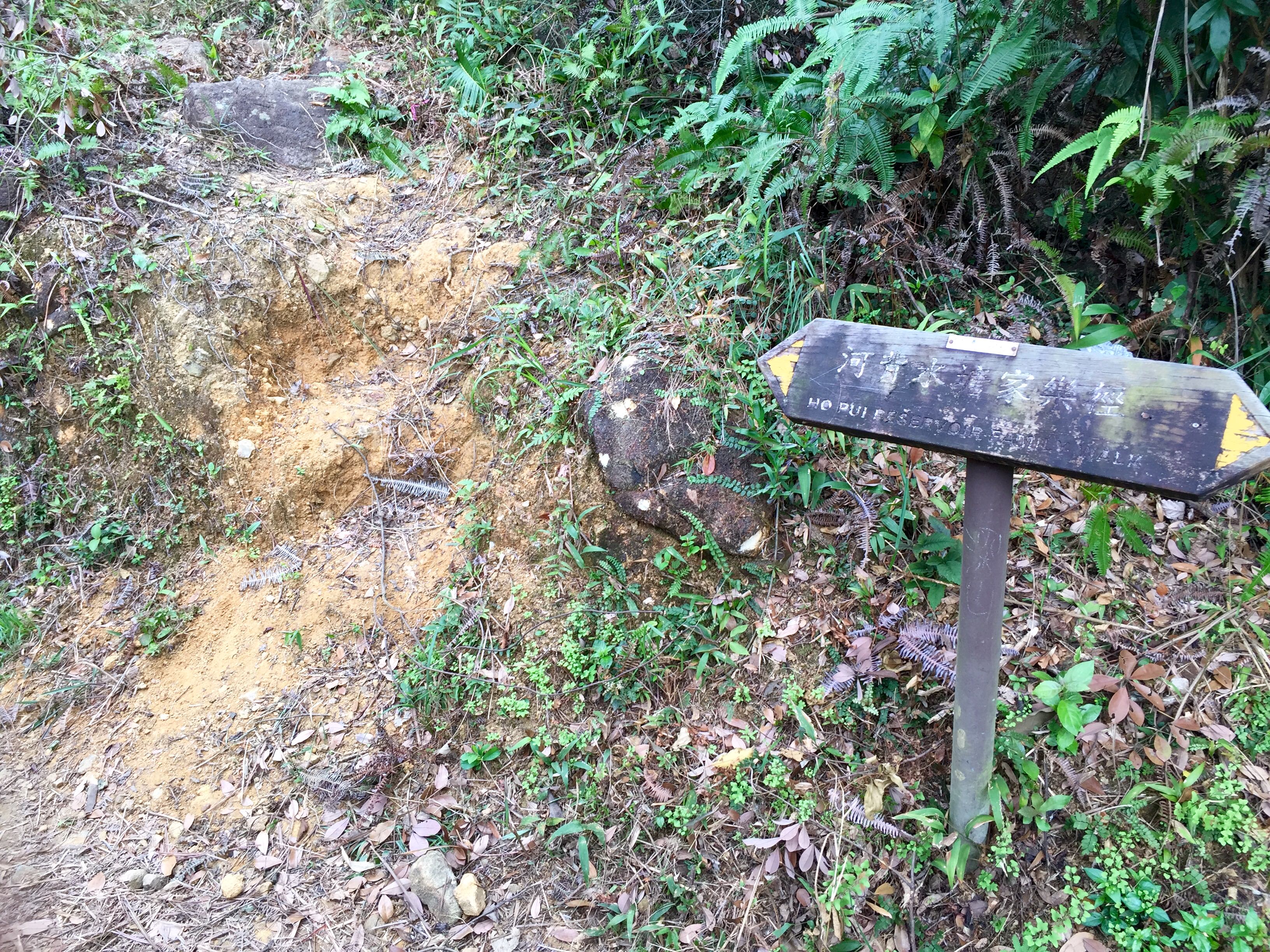
Once on the other side, you’ll see a entrance way on your right titled, “Ho Pui Reservoir Family Walk”.
NOTE: I believe we ended up going too far and up a different trail that was much more difficult, as opposed to going up the steep steps you will see shortly after walking through the entrance on your right. Below, I’ll explain how we made our way up to the next part of the hike, but again, I’m fairly certain you can go up those stairs and get to the same point much easier than the way we did it.
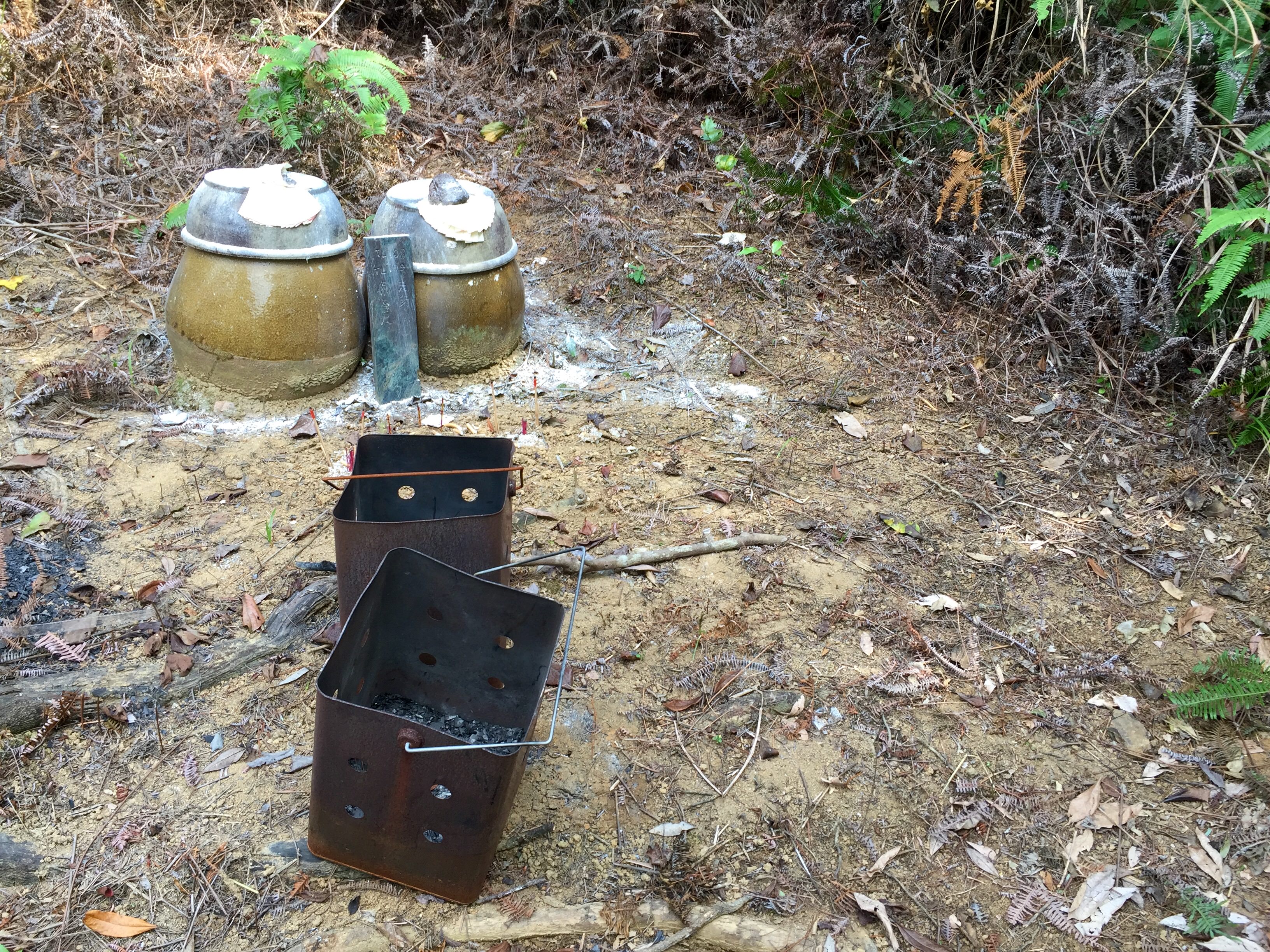
We made our way up a barely-there path to the left of the hill (see first photo below) a few steps after walking along a tiny bridge. Follow this dirt path up the hill until you reach these bowl-type things in a cleared area on the path (see second photo below). You’ll likely feel like you’re lost again, but fear not – we got lost a number of times on this hike just so you wouldn’t.
Yep, Still “Lost”
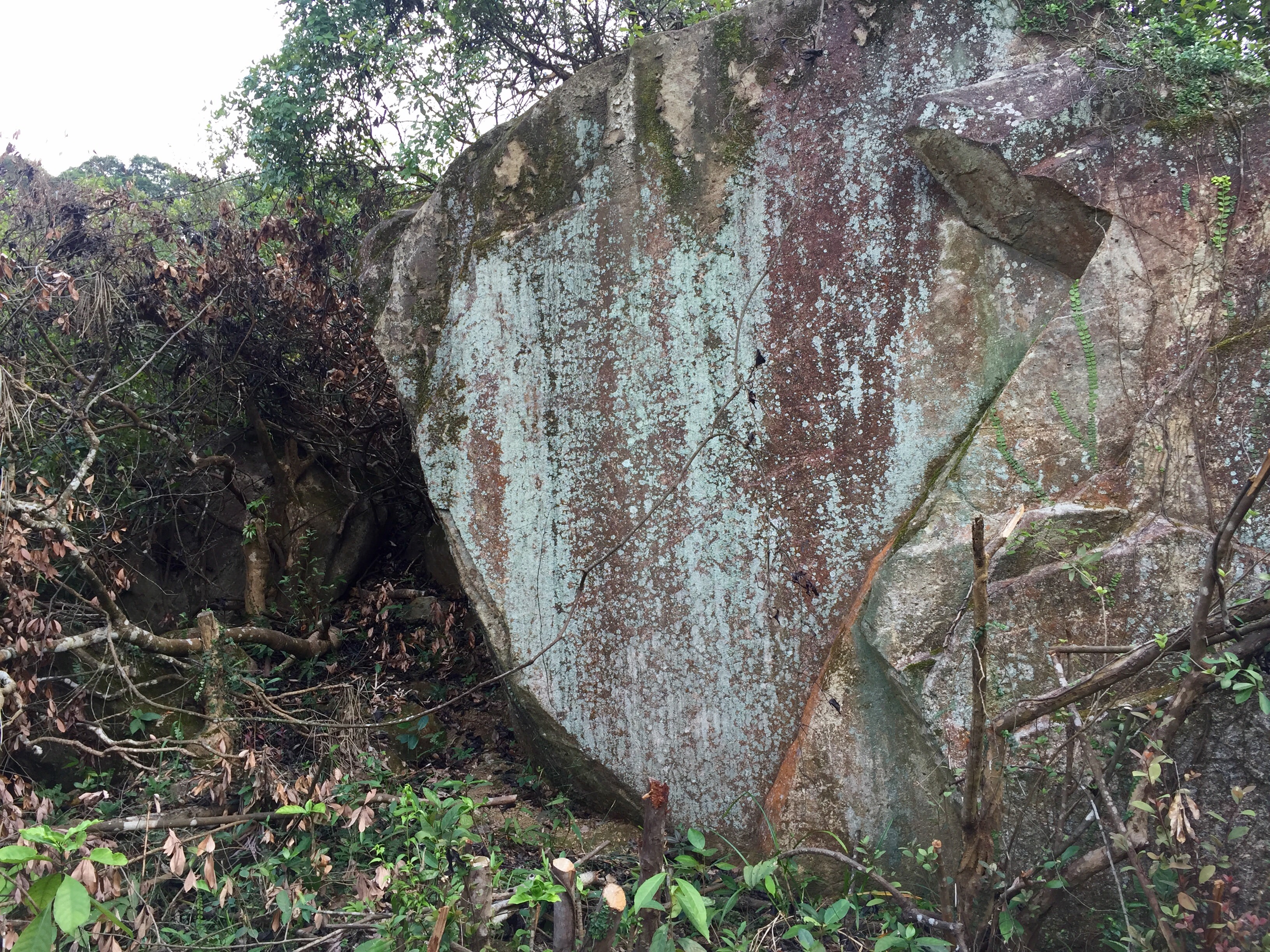
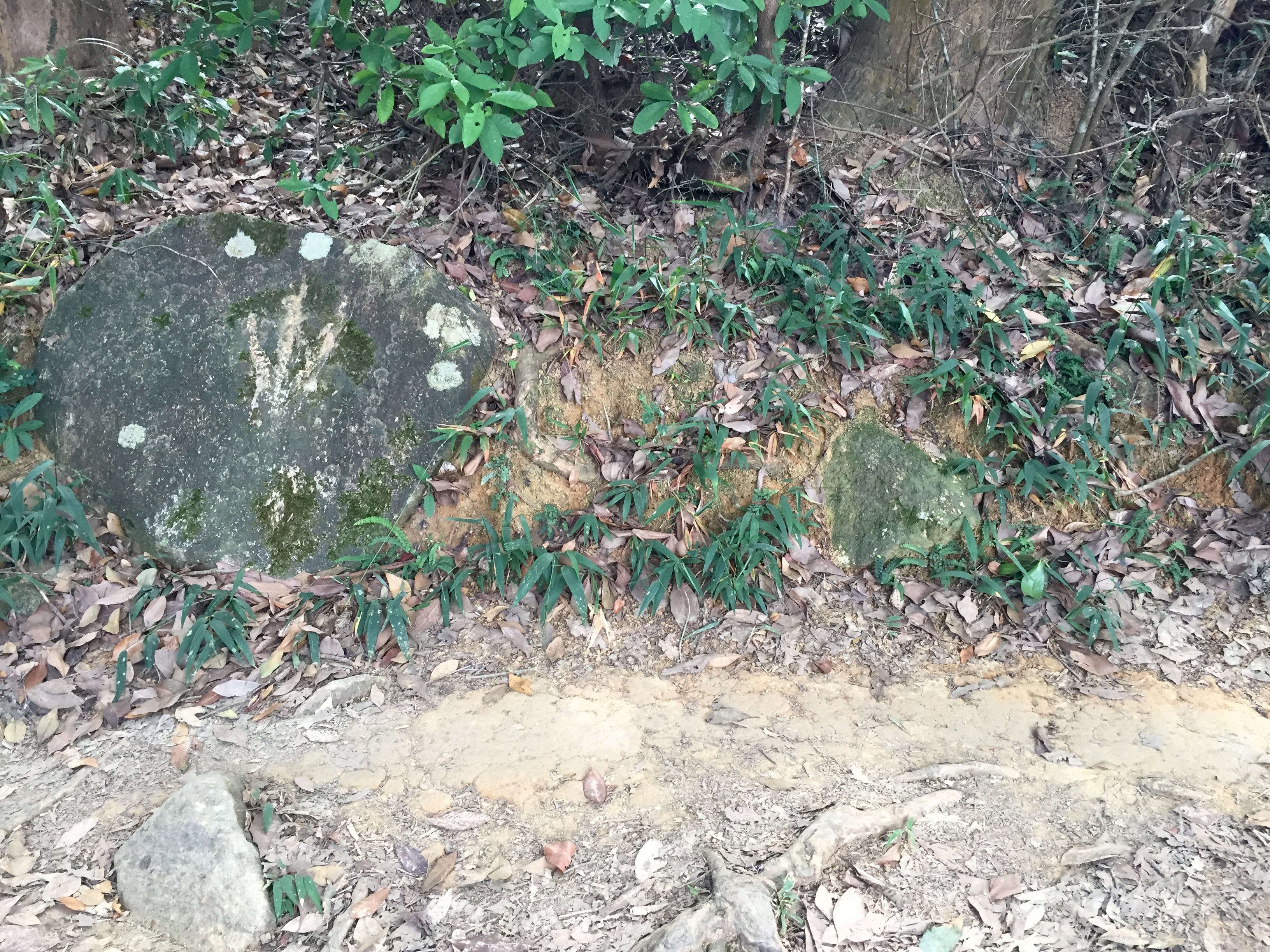
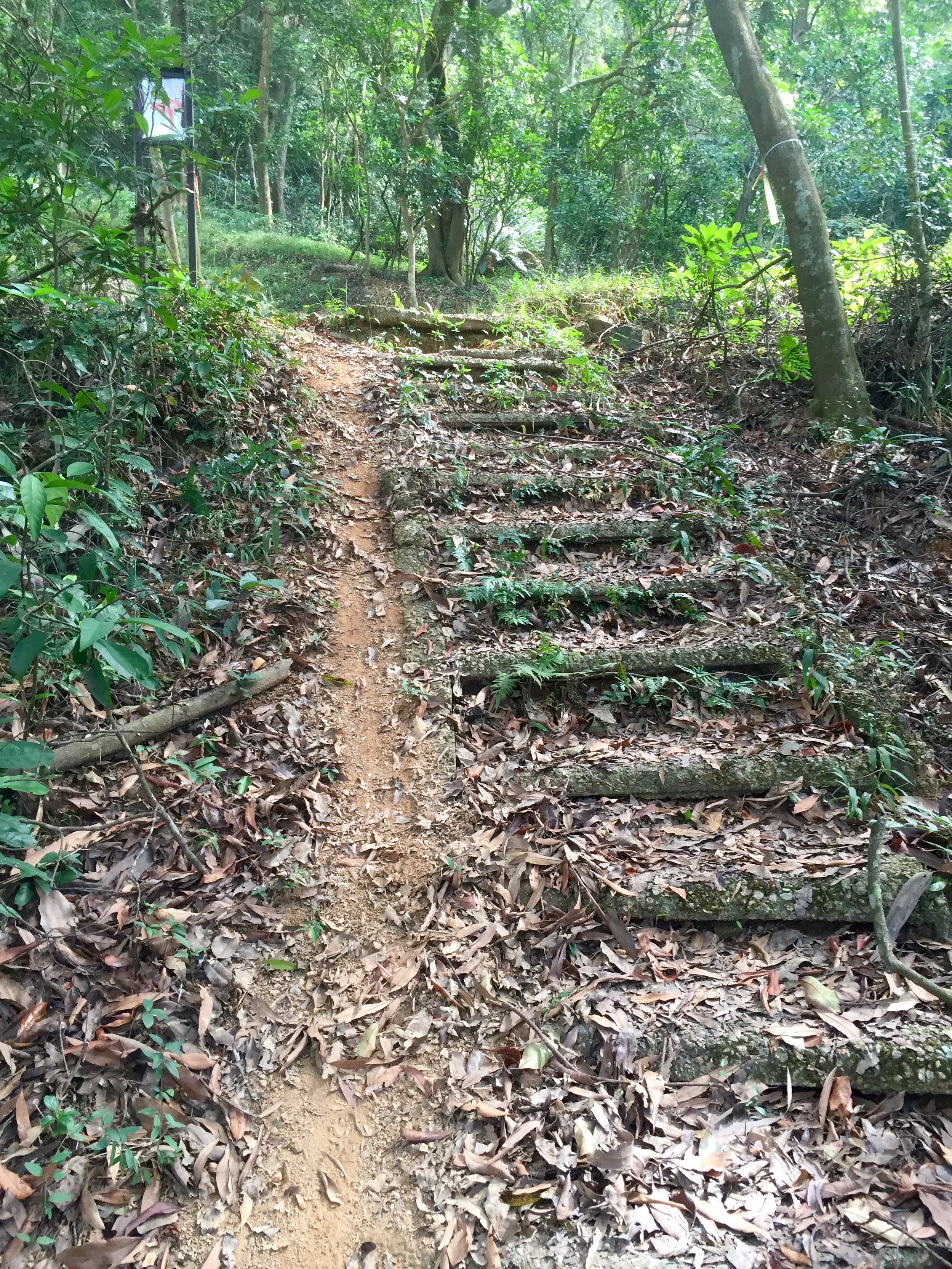
Continue up on the path (and by path I mean a barely-there trail through lots of brush) just behind those random objects found in the clearing. Eventually you’ll come to another open-ish space with a large rock in front of you (see first photo below). Follow the path to your right until you reach an actual trail with a smaller rock in front of it (see second photo below). Turn right and continue on the path until you’re met with a set of grass-covered stairs leading up to a paved road (see third photo below).
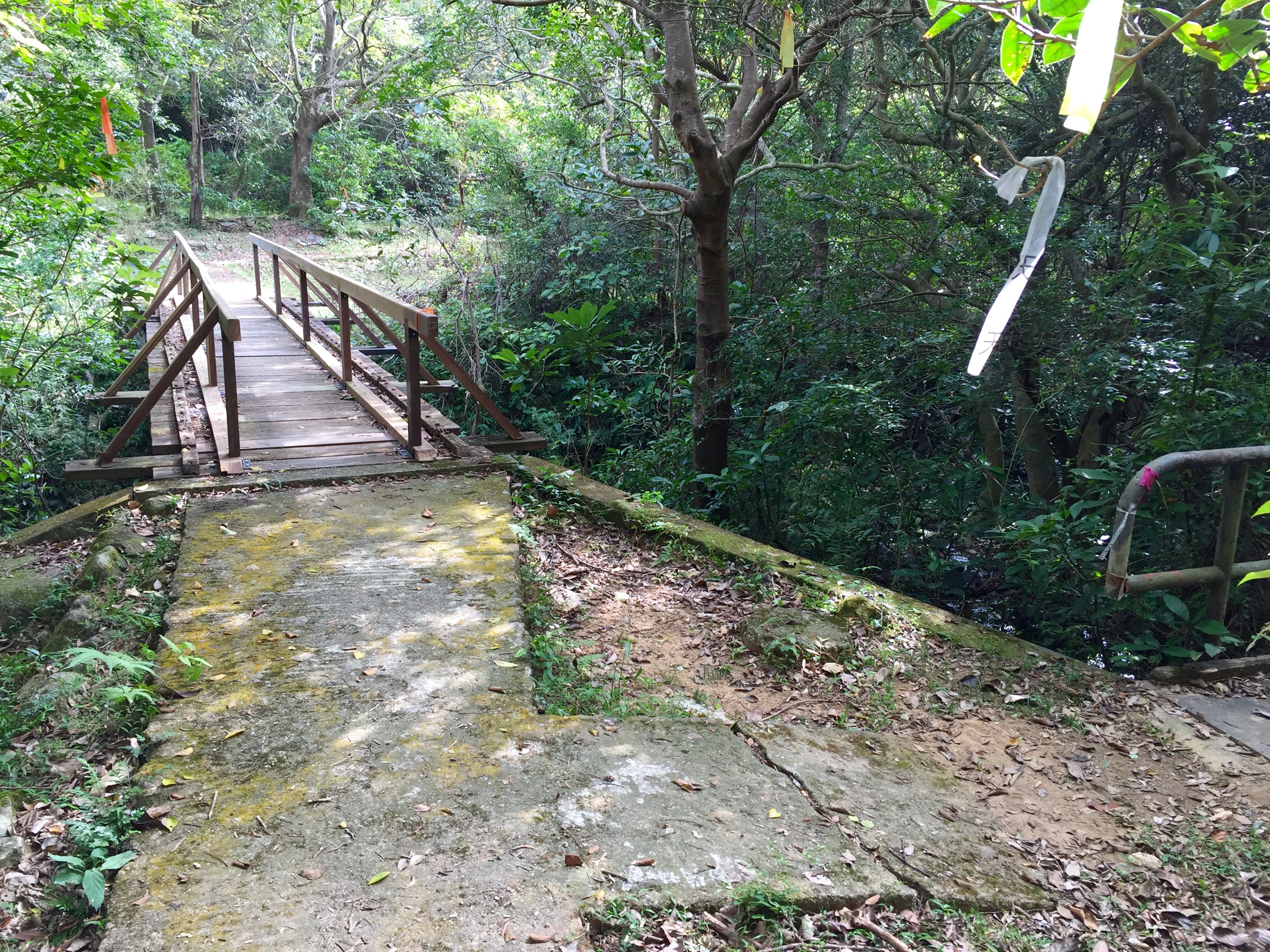
Head up the paved path on your right until you reach another fork in the road. At the fork, you’re going to take a very sharp left and go down the path (on the sign it will say “Route Twisk”) until you see a picnic table on your right (see first photo below). Make your way down the trail behind the picnic table. You’ll be heading down the trail for some time until you reach yet another fork. Continue straight along the bridge (see second photo below) and just keep making your way along – you’ll be going over a few makeshift bridges until you reach another small fork (who actually made these trails so damn confusing?!) in the path. Go right.
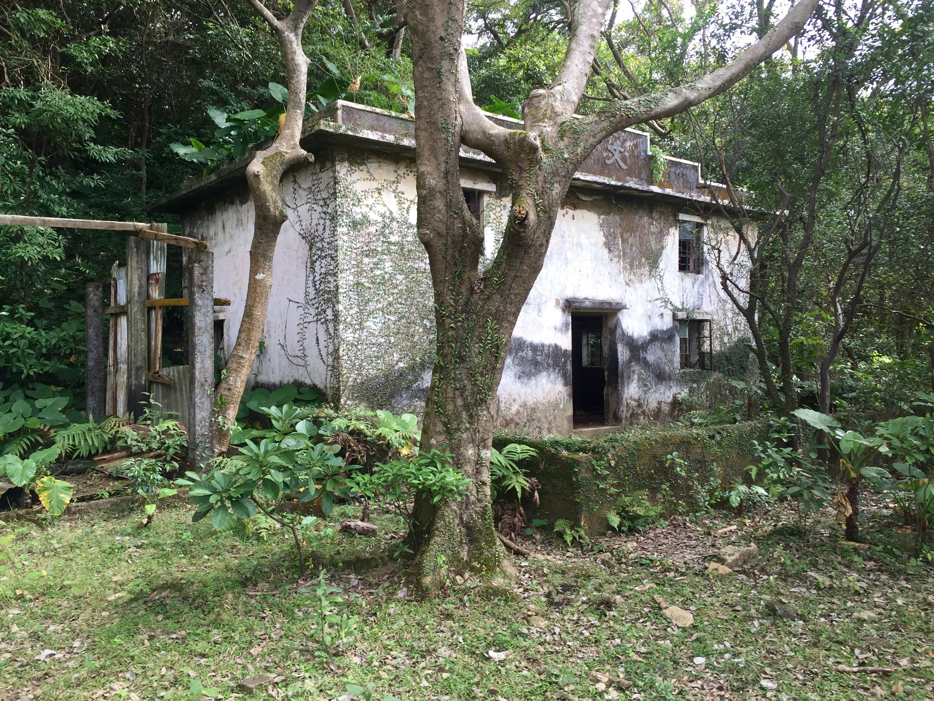
Abandoned Buildings & Lots of Dung
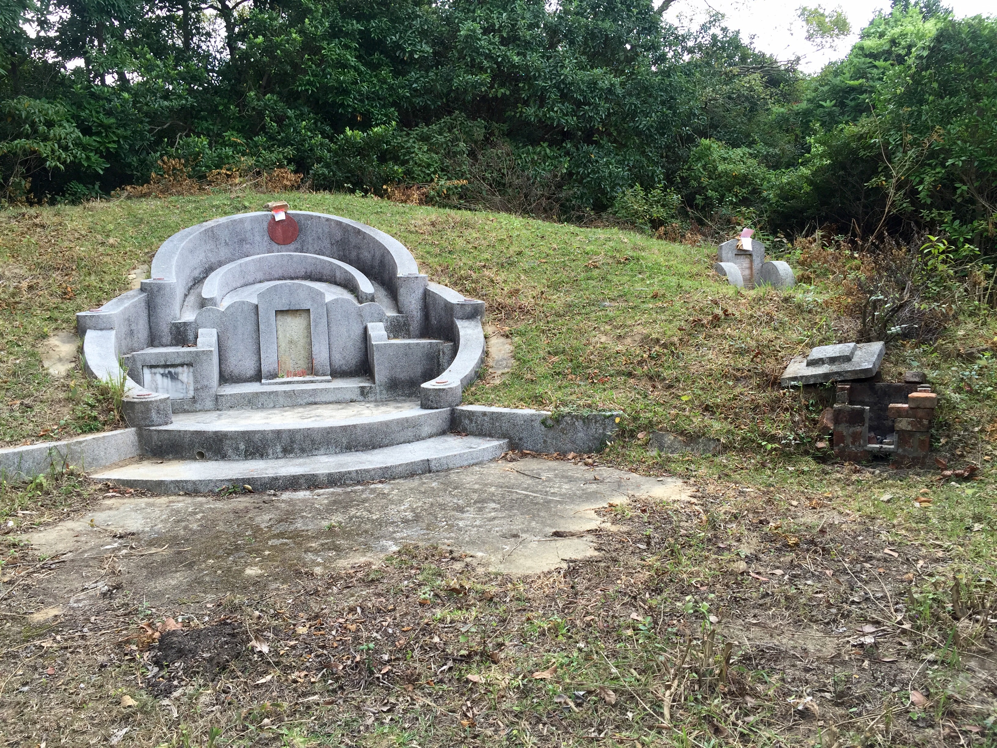
A few steps after you’ve turned right, you’ll find yourself in front of an abandoned building (see first photo below) with big piles of crap – I assume a water buffalo or something along those lines – everywhere. After you’ve spent a few minutes wandering about, continue down the path. Keep going until you find yourself out onto a rather large open clearing. Go left and continue along a path – you’ll pass some type of Chinese shrine (anyone know what this actually is?) along the way until you reach a fork in the road (see second photo below). Go left towards “Tseun Wan Chai Wan Kok”, as posted on the sign in front of you.
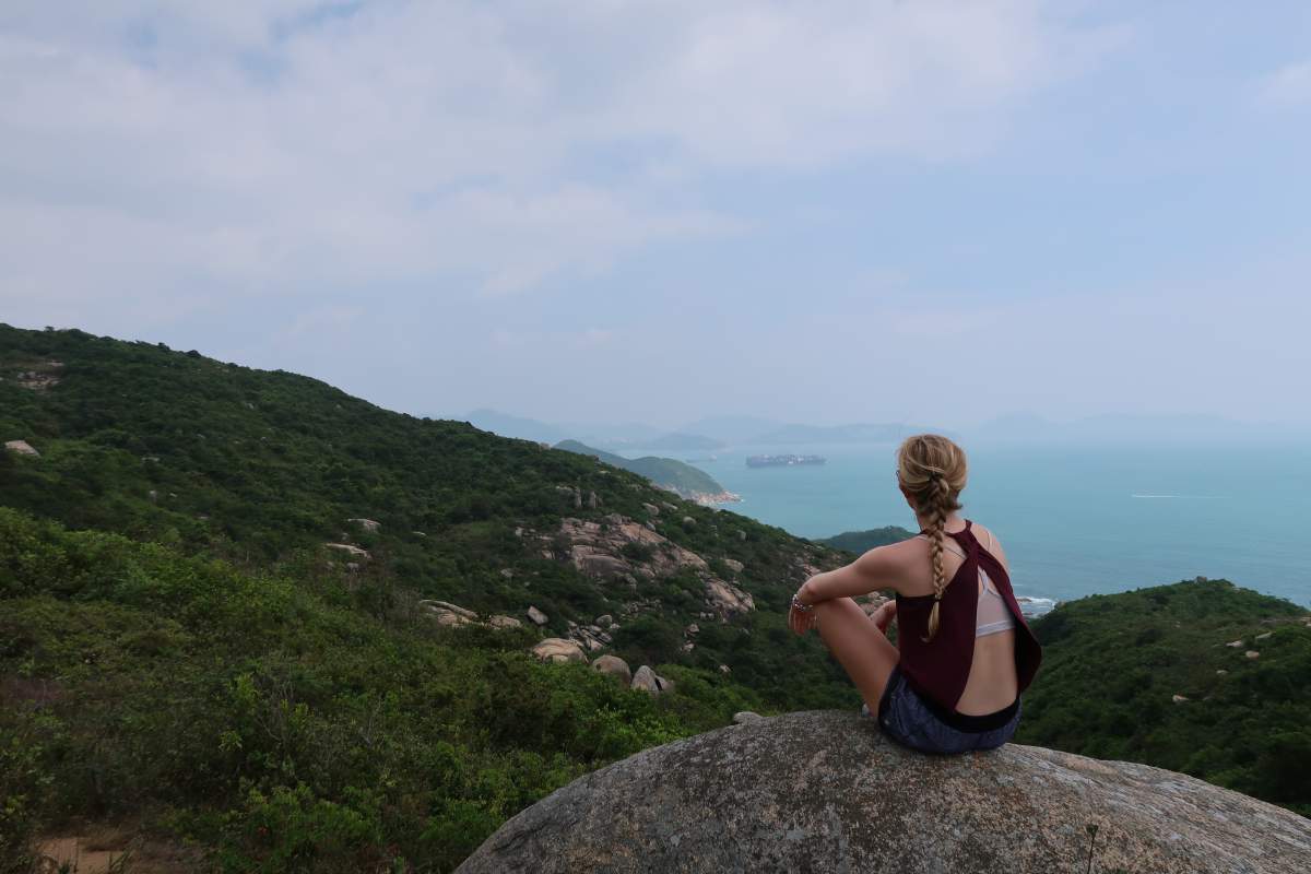
The Best Part
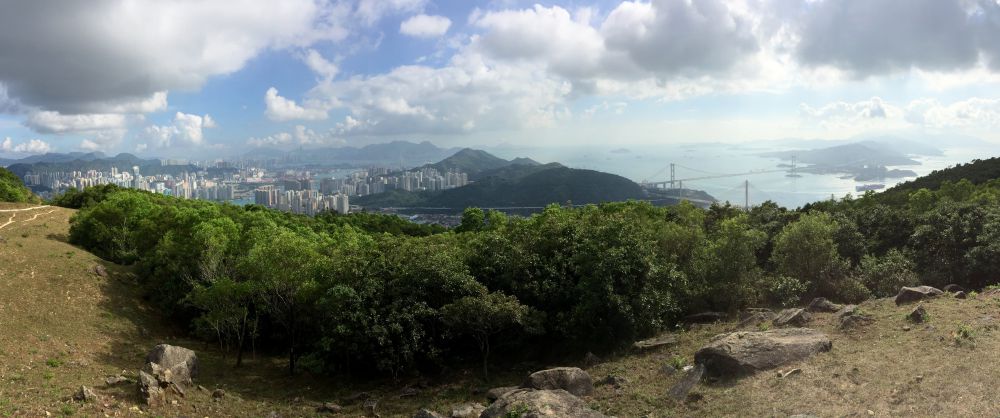
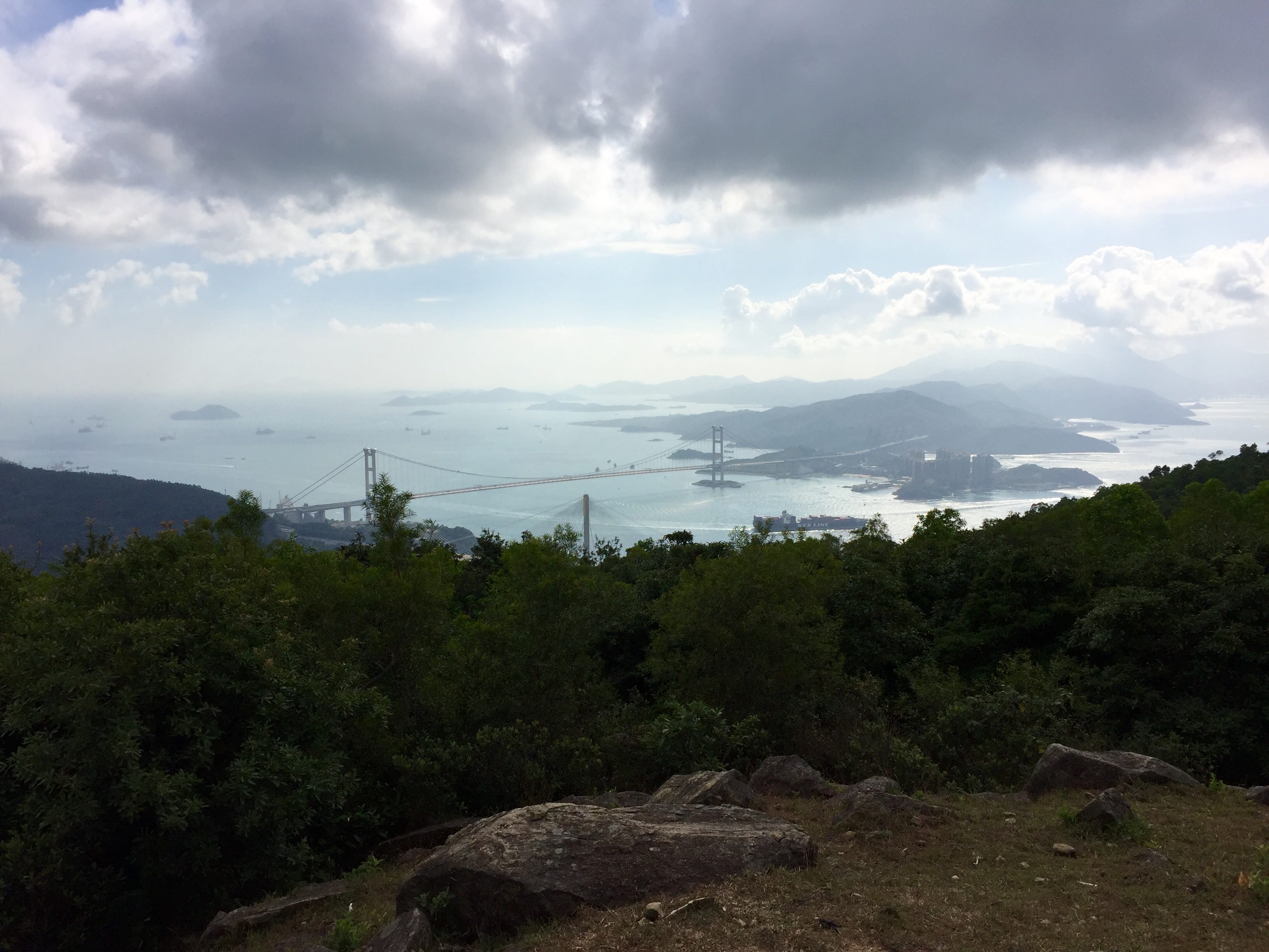
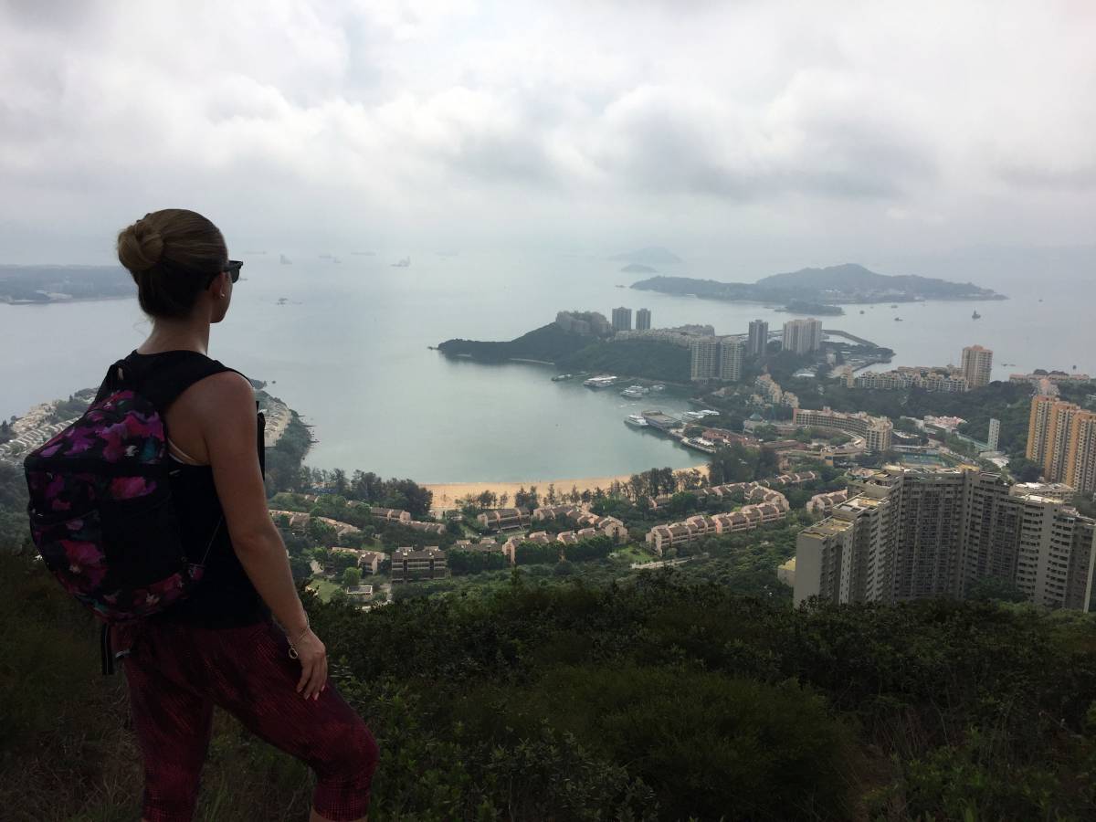
Continue down the path, which will eventually turn into a stone footpath called the “Yuen Tsuen Ancient Trail”. All you have to do is follow this path and all of your efforts will be rewarded with these amazing panoramic views of Tsing Ma and Ting Kau bridges:
Getting Home
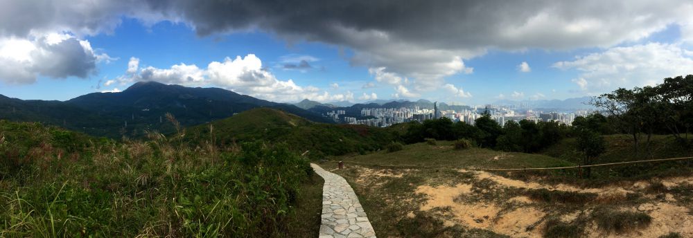
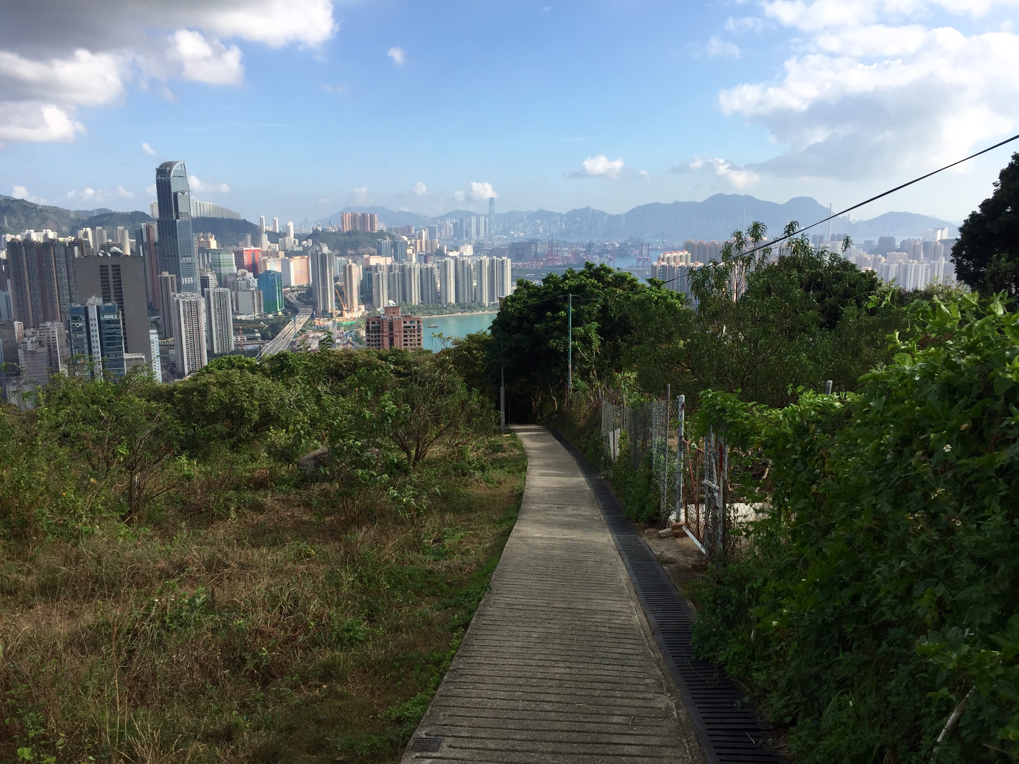
After you’ve taken it all in, keep following the path, most of which id lined with green railings, down to Tseun Wan. At one point, you’ll come to a road with cars parked alongside – the path continues down just to your left and on the other side. Upon exiting the path, you’ll find yourself on a street called Tseun King Circuit. From there, the MTR is about a 15 or so minute walk and there’s also a bus station about 10 minutes away to get your exhausted and accomplished self home.
Journey Length: About 12 – 14 km
Journey Time: About 3 – 3.5 hours

Nick
November 19, 2015 at 1:23 pmLooks like an interesting hike that I should check out. You know those “Bowl-type” containers that you described and showed in one of your pictures are actually containers for skeletal remains of a deceased person. It is an old village practice to dig up the skeletal remains of a deceased family member and place them in these containers once the flesh is full decayed.
Also, due to the limited space in Hong Kong, some cemeteries do not offer permanent graves, and you are only allowed to use it for a defined number of years. Thus, after your “lease” is over, you have to return the grave and remove the remains. Usually, there are specific places that rest these containers, but in the New Territories, there are special rules for the indigenous residents.
The “Chinese Shrine” you showed in the other picture is in fact a traditional chinese grave. They are very common in the new territories, and have the coffin buried underneath.
thisgirlabroad
November 19, 2015 at 1:27 pmWow – I had no idea!
Thanks for the info, Nick. Really interesting stuff!
Raisa
December 11, 2015 at 2:18 pmHi! Love this blog! I’m visiting Hong kong for the new year! Just wondering what the weather is normally like around then? Thanks, Raisa
thisgirlabroad
December 11, 2015 at 8:47 pmHi Raisa,
So exciting – I’m sure you’ll love it here! I personally find it very cold (and I’m from Canada!). It’s hard to explain the chill factor, as the temperature will be around 15 degrees, but it will honestly feel like it’s below 0. There is relatively no insulation or central heating systems in place, which means there’s little escape from the cold. At the end of the day, I would definitely pack for “winter” weather. Hope that helps and let me know if you need anything else!
Maura
December 8, 2015 at 9:36 pmI do not even know how I ende up here, but I thought this post was great.
I don’t know who you arre but definnitely you are going to a famous blogger if you aren’t already 😉 Cheers!
thisgirlabroad
December 8, 2015 at 9:52 pmHaha, thanks so much Maura!
Lauren
February 28, 2016 at 5:36 amHey, I’m wondering if there’s a lot of insects (like mosquitoes) in hiking areas (specifically around May)? Thanks
thisgirlabroad
February 28, 2016 at 2:46 pmHi Lauren,
It honestly depends what hike you do and what time of the year you do it in. I’ve just come back from a hike and there were no insects. Wouldn’t hurt to bring along some bug spray just in case though!