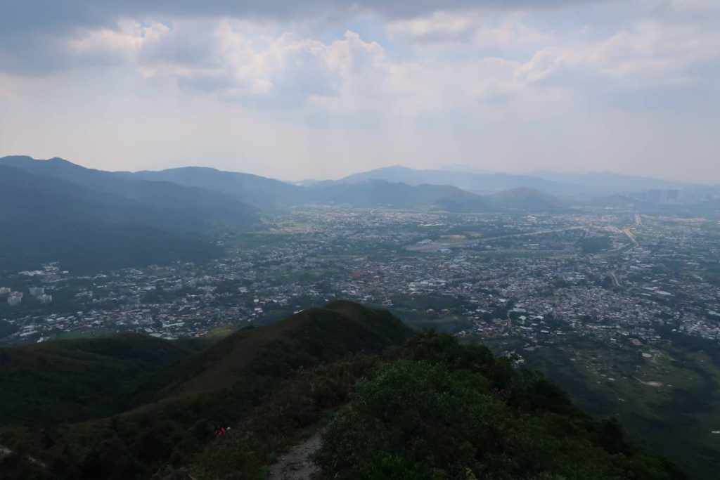
If you’re looking for a fun, semi-challenging hike that is both easy to get to and to get home from, I would recommend checking out Razors Edge Ridge Hike (Tai To Yan), Hong Kong. Located in Lam Tsuen, this hike takes you through a few kilometres of interesting trail walking before you climb out onto the ridge. The ridge gives you 360 degree views of the surrounding area, including Tai Mo Shan, Fanling, and – if the skies are clear enough – Shenzhen in the distance.
Starting Point of Razors Edge Ridge Hike (Tai To Yan), Hong Kong
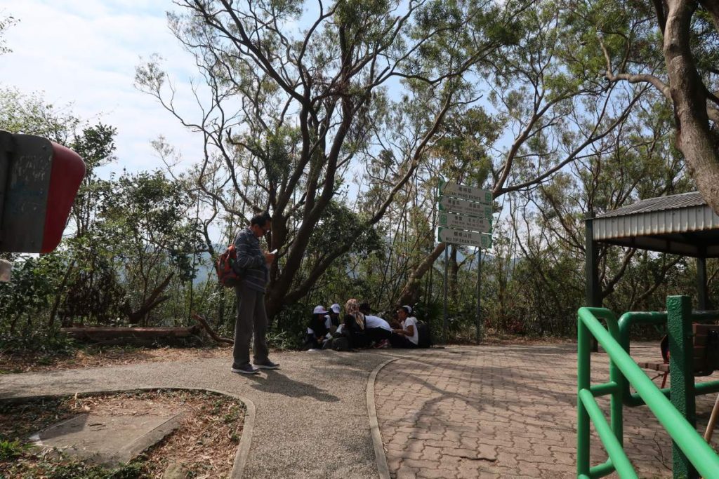
Head to Fanling MTR Station and go out Exit B. Cross the street ahead of you (Pak Wo Rd.) and follow the signs that say “To Wishing Tree”. The trail for Wu Tip Shan starts beside a taxi stand, has a sign, and is paved – you’ll likely see other hikers starting and ending here as well. This will lead you towards the Wu Tip Shan Lookout (it’s easiest to follow Google Maps for this bit).
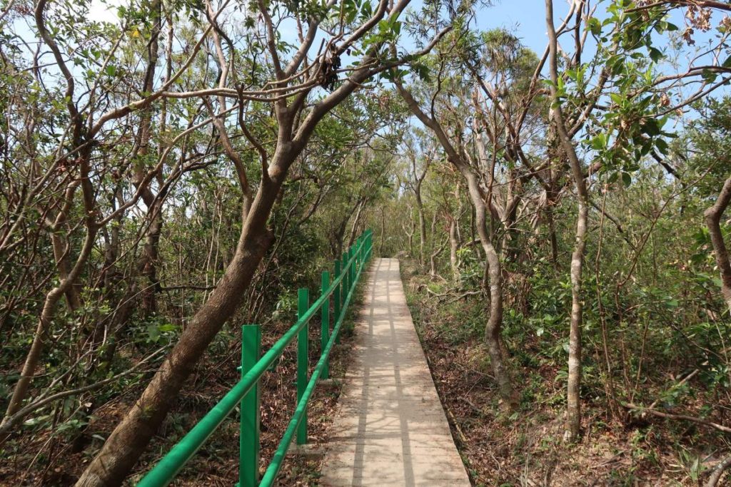
Wu Tip Shan Path
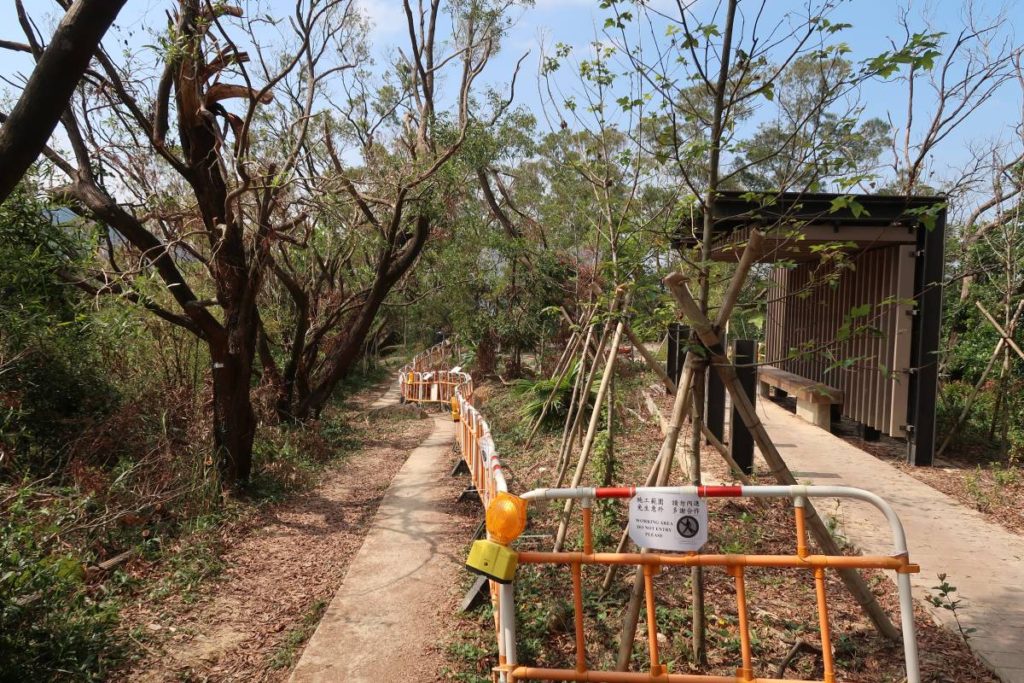
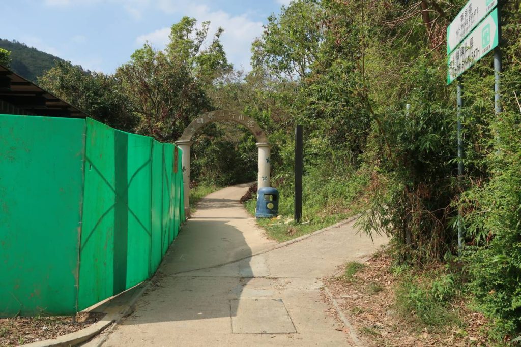
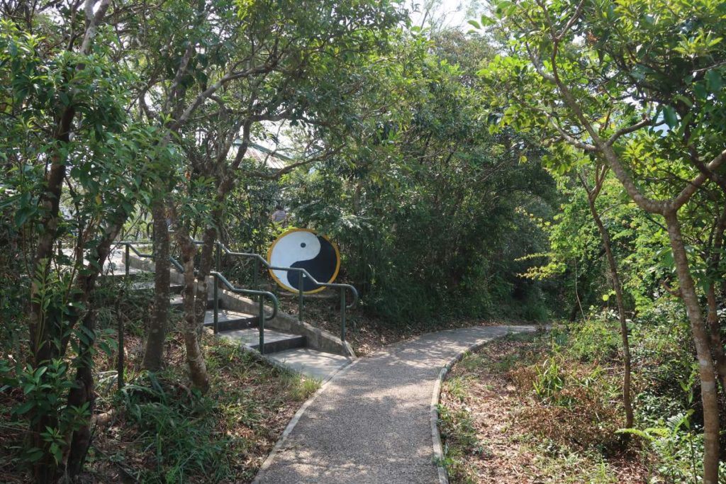
You’ll be following the Wu Tip Shan Path until you get to Tai To Yan. Most of this path will be paved and you’ll essentially just be going straight. At the start, you’ll see a few signs that lead you towards the Wu Tip Shan Path (pictured in the second photo above) – keep following this path and stay straight on the same path when you get to any forks in the trail.
There was quite a lot of construction – looked like they were adding covered benches – during this bit of trail. You’ll walk past a few gazebos and sitting areas, but there’s honestly not much else to see. This part of the trail is very easy – relatively no elevation.
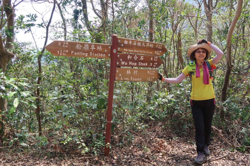
You’ll eventually begin following the signs that say Pak Tai To Yan instead of Wu Tip Shan Path. Keep following the same trail – it will become less built-up and you’ll soon be walking along a dirt path. Keep on the same path and continue to follow the signs to Pak Ngau Shek via Tai To Yan (Razors Edge Ridge). From the last photo above, it’s about a 30 minute climb to get up and out onto the ridge (the first photo below).
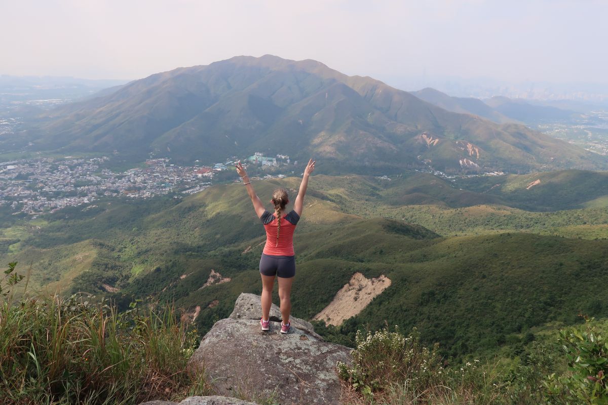
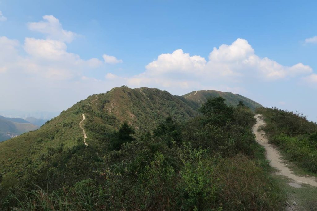
Tai To Yan (Razors Edge Ridge)

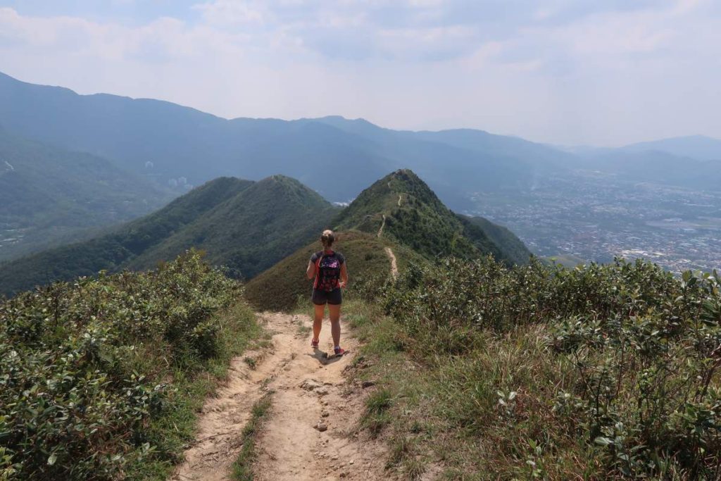
These are some of the first views after you come out from the path and up onto the ridge. If you make it out on a clear day, you’ll be greeted with stunning views of the surrounding rolling mountains and city below. I honestly loved the views here – everything was picturesque so make sure to stop and take a snap (or ten!).
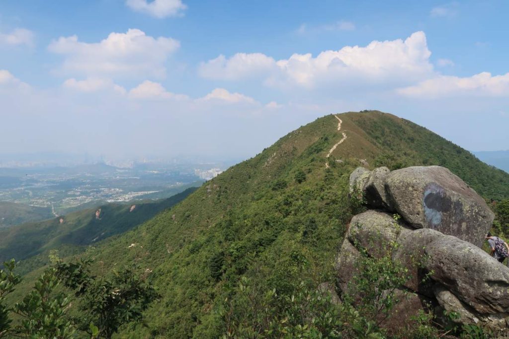
From here, just continue to follow the ridge back (Tai To Yan Path) all the way down. There’s also a cool spot closer to the end of the trail, before you begin the descent, where a bunch of large rocks are stacked on top of each other. They’re easy to climb up on and make for a good viewpoint and photo. As you continue along the path, there will be a few forks. Continue going straight down. This will take you right to the end of the hike.
Ending Point of Razors Edge Ridge Hike (Tai To Yan), Hong Kong
Once you finally get down the mountain, you’ll be on Lam Kam Road, right across from the Kadoorie Farm. Just to your left you’ll see a bus stop – this will take you to Tai Wo MTR station. Both bus routes (64K and 65K) will take you to the MTR station, so just hop on whichever comes first.
Journey Length: about 10km
Total Time: around 4 hours