I’m always on the hunt for a great hike that offers fantastic views of Hong Kong. I had heard about Suicide Cliff and after seeing some photos on social media, I knew I had to check it out for myself. Suicide Cliff Hike is an easy hike to get to, offers insane views of the city, and really isn’t that difficult.
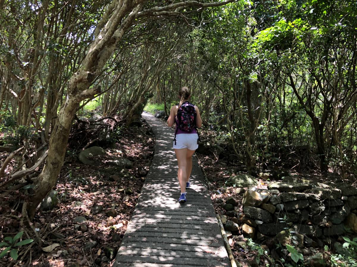
There are a few different ways to start the Suicide Cliff Hike. We chose to take the longer route because I didn’t want to hurt myself trying to climb up an incredibly steep hill (when we made it to the actual cliff, we saw people who had just climbed up it. They said it was crazy and that there was no way they would recommend it). We also wanted to go on a longer hike, so it just made sense to make a day out of it.
Starting Point of the Suicide Cliff Hike Kong Kong
Head to City One MTR Station and go out Exit D. Turn left and head down Chap Wai Kon Street – cross the street at the first crosswalk so you’re on the other side. Alternately: if you’re a bit pressed for time and/or want to avoid a relatively boring 30 minute walk to the start of the hike, take a taxi to the Wong Tai Nau Bus Terminus
City One MTR to Wong Tai Nau Bus Terminus
Continue walking down Chap Wai Kon Street until you reach Siu Lek Yuen Road. Turn right and keep going. After about 5 minutes, you’ll walk under an underpass. Turn left when you exit the underpass and continue walking up along Siu Lek Yuen Road. Eventually, you’ll see the Wong Tai Nau Bus Terminus on your left. Cross the street shortly after the terminus – you’ll see a set of stairs leading up. This is where the hike starts.
Wong Tai Nau Bus Terminus to Kowloon Peak Viewing Point
After you take the stairs up, head along the path to your left. You’ll pass a building on your left and will eventually reach the end of the path. Go right and walk down the road.
After a few minutes, you will veer left and head into a more forested area with a walking path. Shortly after, you’ll again come to a crossroads with a map at the end of the stairs. At this point, turn right and continue along the path – you’ll now be walking along a rough stone path in the forest.
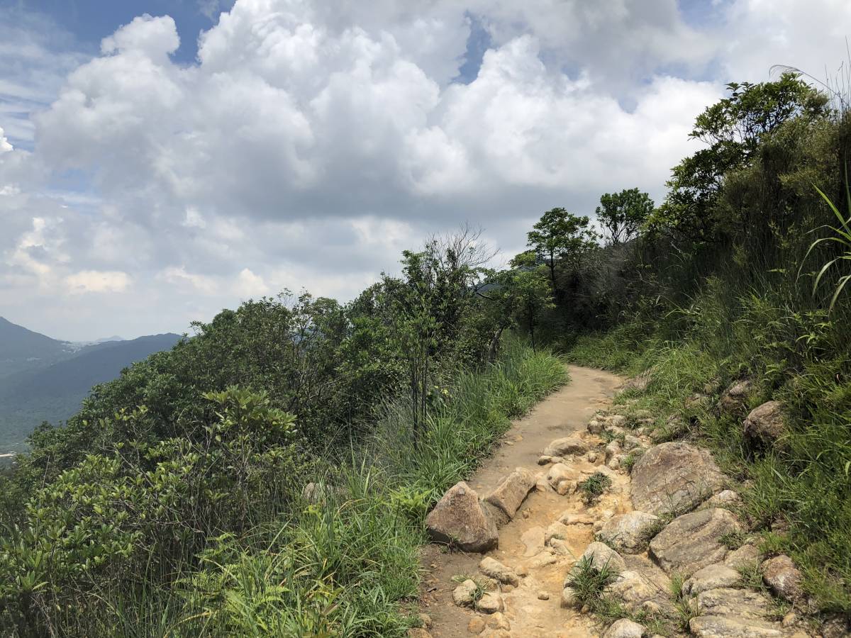
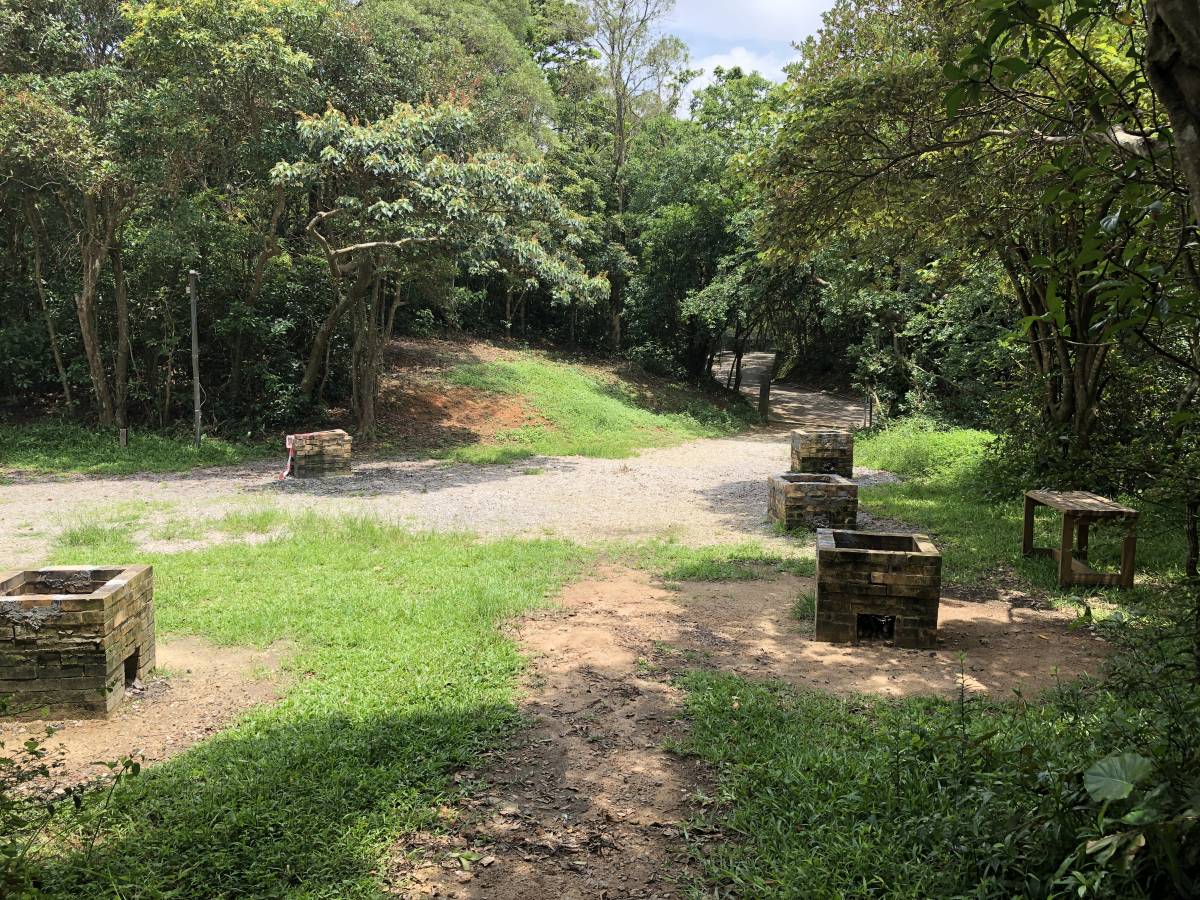
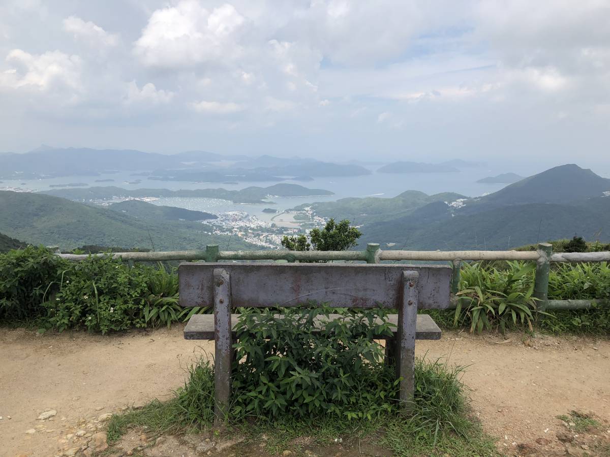
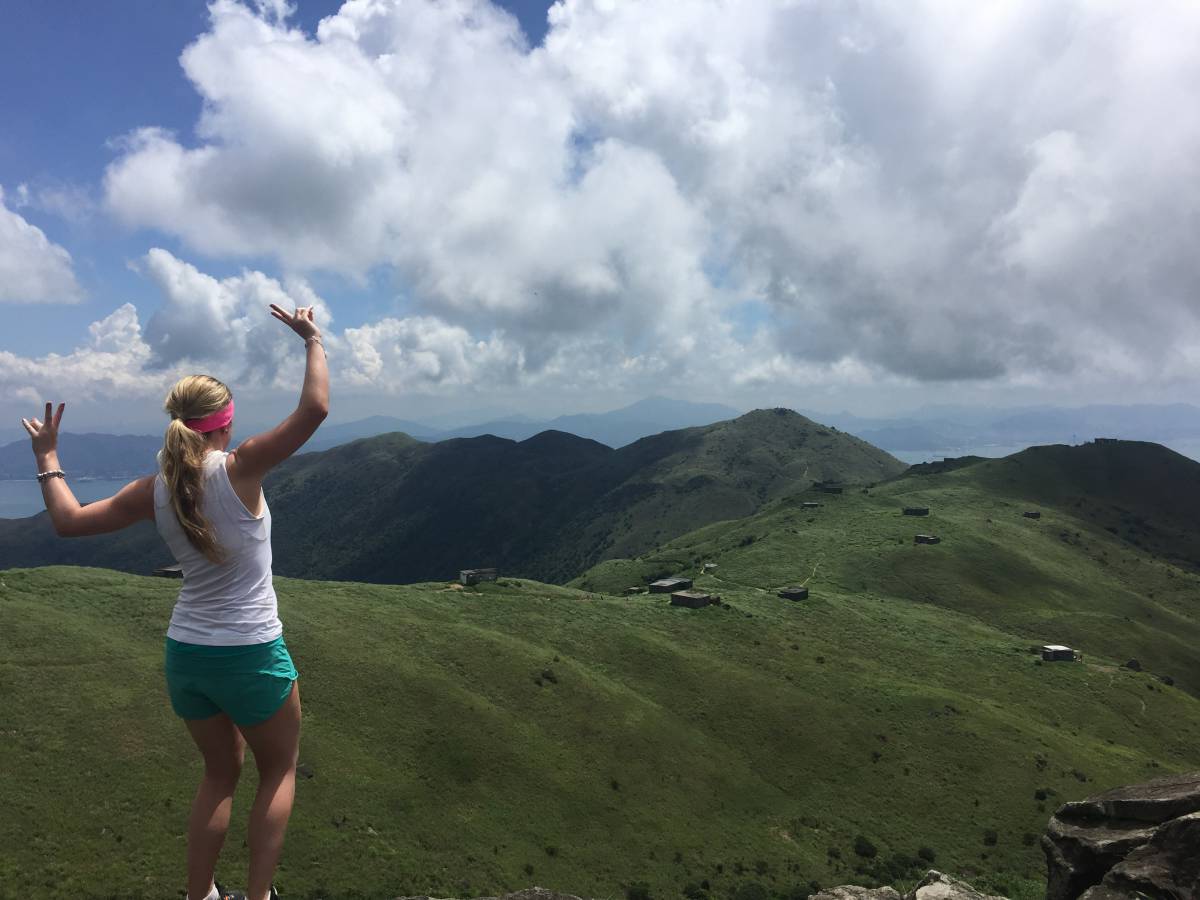
After about 30 minutes, you’ll begin to see the path marked as “Maclehose Trail” – follow that and shortly after you’ll come up out of the forested area and onto a clear path on top of the mountain. You’ll walk along this path for a little while, but will dip back into the mountain and under some shade. You’ll also pass by a few ‘clearings’ that look similar to the second photo above. Just go through them and keep following the path.
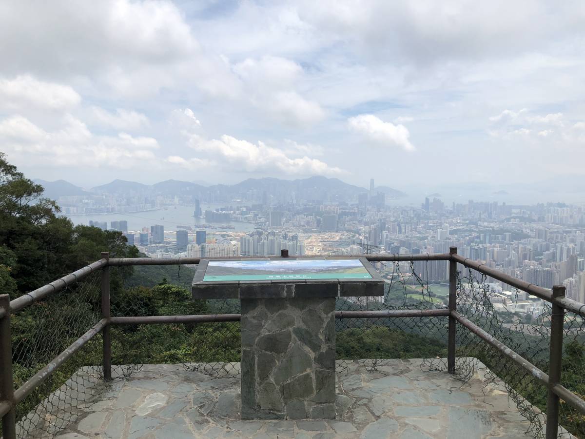
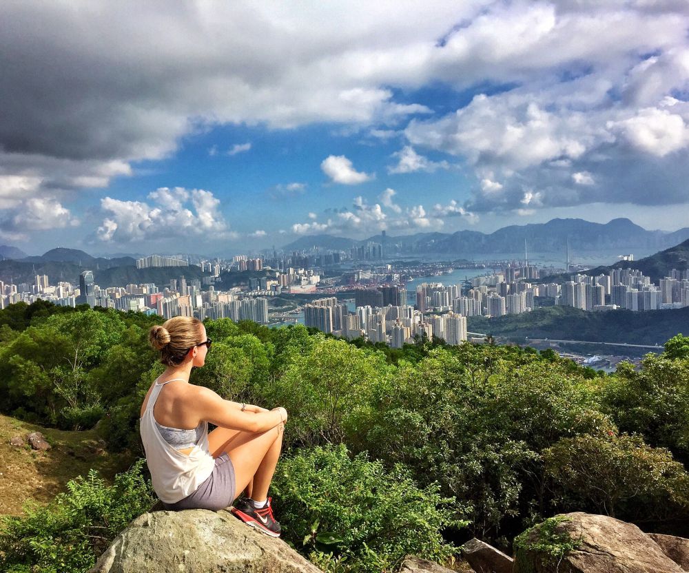
Afterwards, you’ll find yourself walking along an actual road. This road will take you directly to the Kowloon Peak Viewing Point. At the lookout area, you’ll see a gazebo. There are stairs leading up just behind the gazebo – it’s a short climb up to another view point (see second photo above). When you’re ready to move on, head along the path behind the gazebo that goes down.
Kowloon Peak to Suicide Cliff
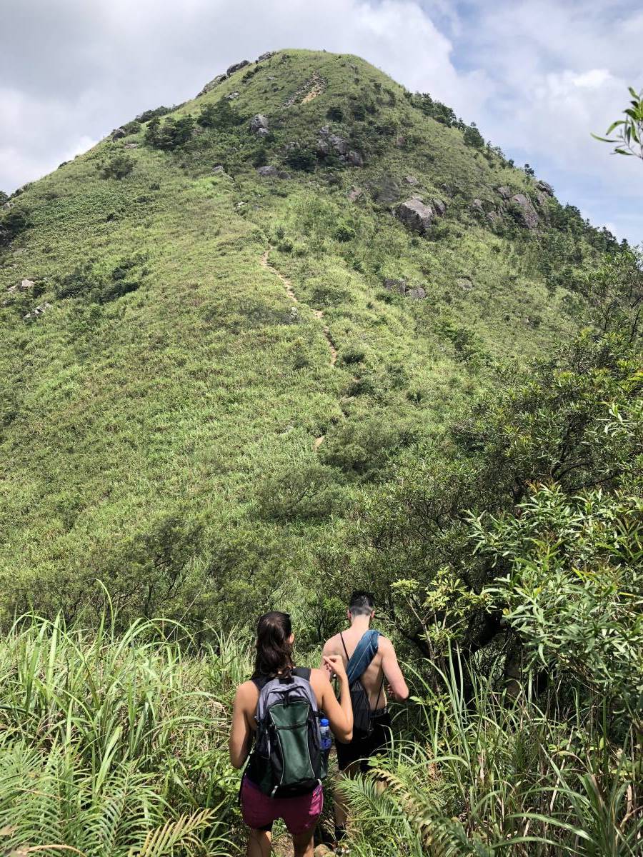
From here, simply follow the path until you can’t go any further. You’ll be hiking up and down a few mountains and will eventually come to a rock on your right with a great vantage point of the city – perfect for a quick photo before continuing on.
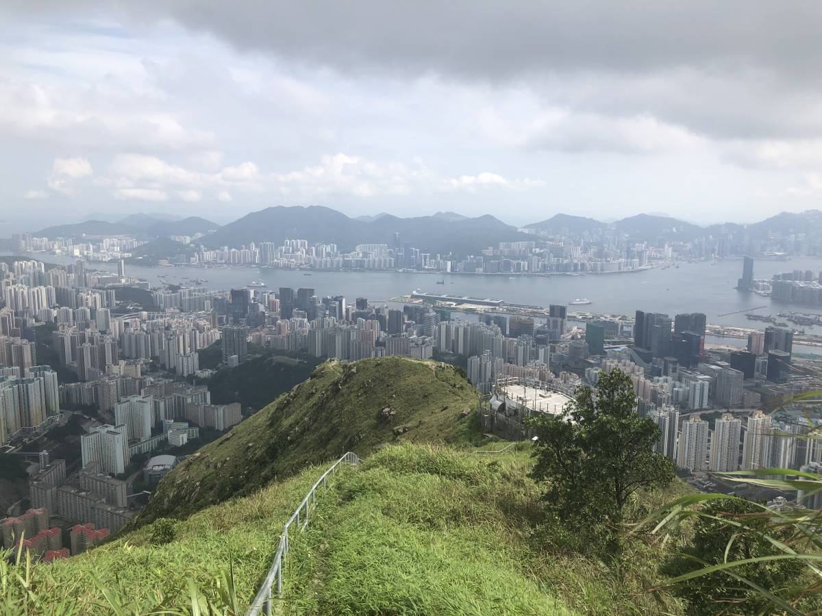
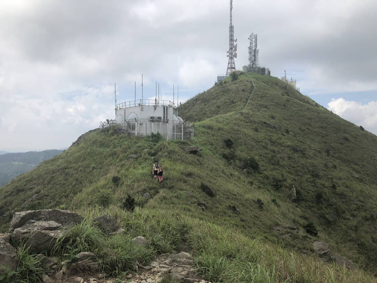
The peaks will become much smaller and you’ll be able to see a television and radio transmission station in the distance. Once you reach the station, you’ll walk past a helipad and around the station. Continue along the path until you’ll have to climb down a cluster of big rocks.
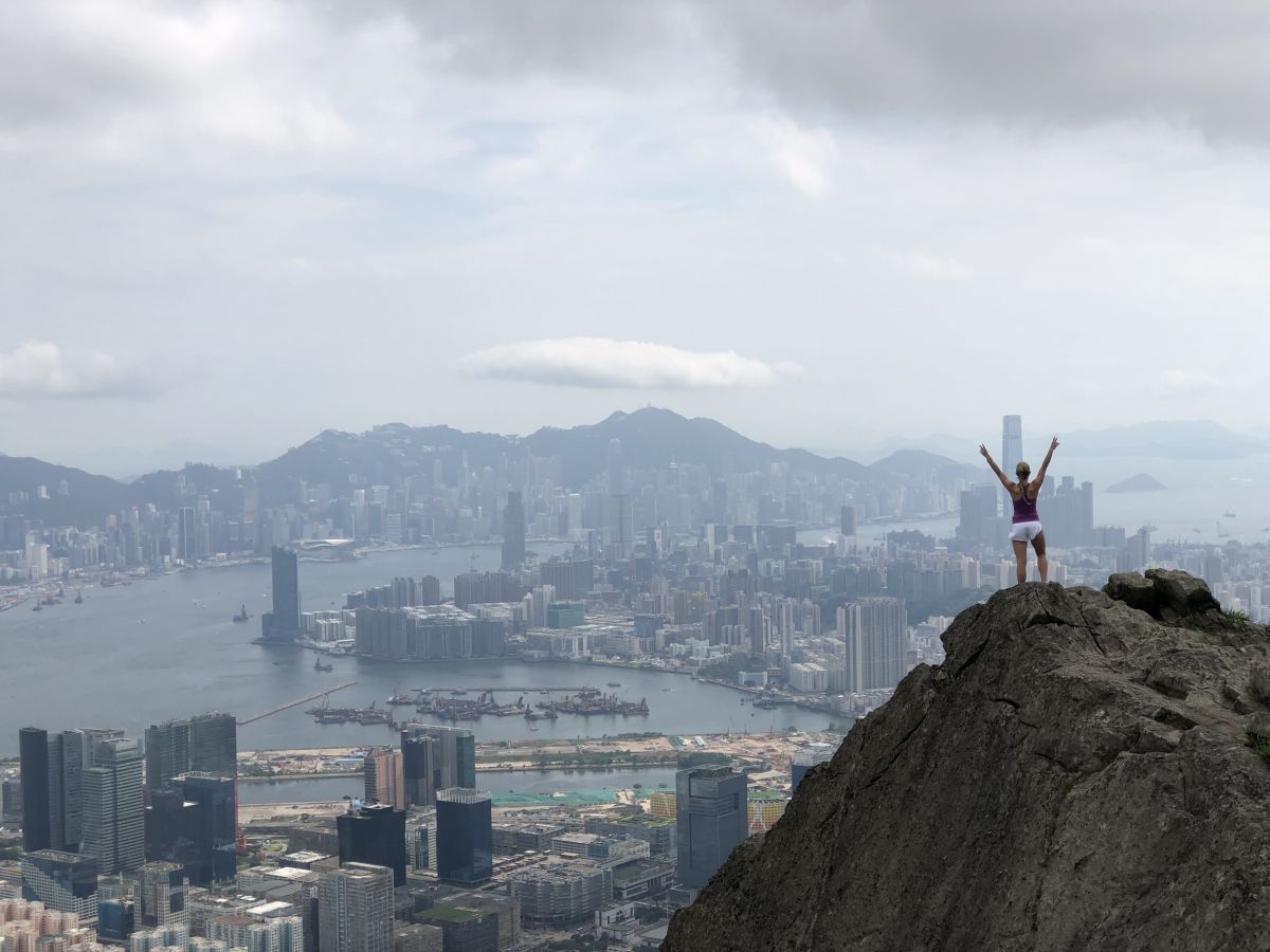
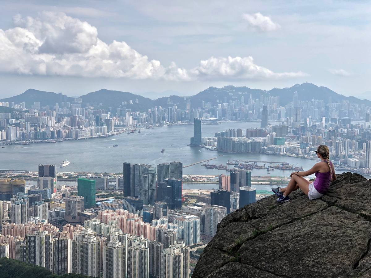
At this point, you’ll come to a large rock on the cliff that overlooks the Hong Kong harbour. At first, we were wondering if this was Suicide Cliff as we couldn’t see anything else around that rock. Thankfully, some other people were there and told us that Suicide Cliff is literally just below. A word of caution: be careful when climbing down and making your way to the actual cliff – it’s all too easy to slip and seriously hurt yourself.
Suicide Cliff
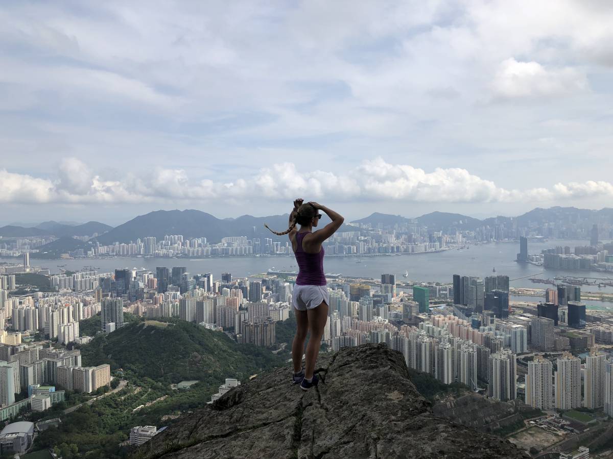
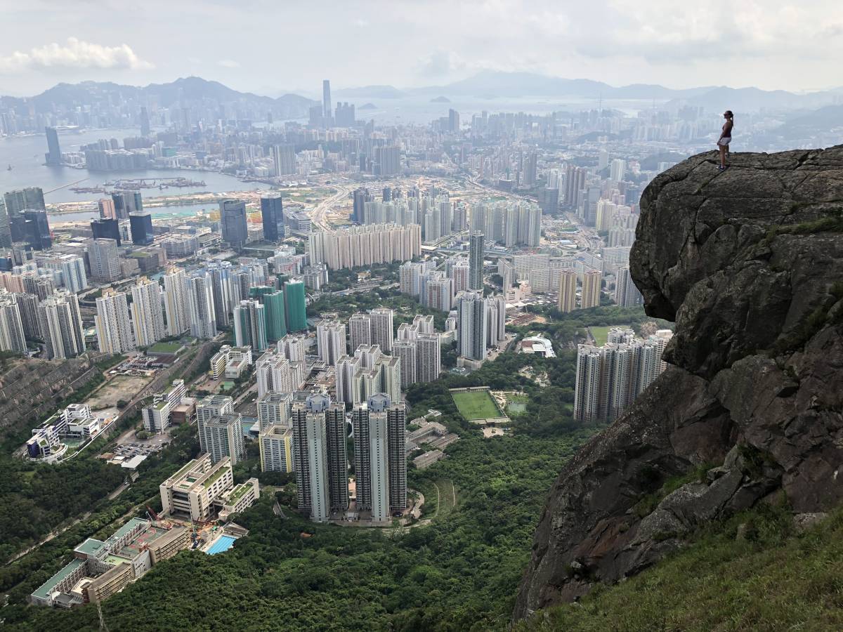
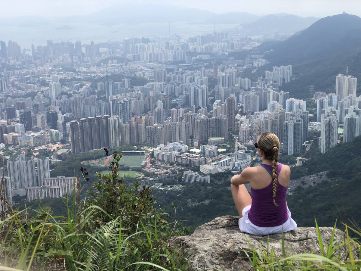
Congratulations – you made it! We were lucky that no one else was there, so we were able to spend time taking photos and enjoying the stunning scenery around us. I’ve done a lot of hikes in Hong Kong, but these views from the Suicide Cliff hike were definitely some of the best I’ve seen.
Ending Point of Suicide Cliff Hike Hong Kong
After you’re done at Suicide Cliff, head back up the way you came – past the transmission tower and into the grassy path for a few minutes before you reach a fork. Turning left will take you back the way you came, so be sure to continue heading down (veering a bit to the right) the path. This will eventually take you to Fei Ngo Shan Road. Keep walking down the road until you get to the main road. Cross the main road and you can either hop in a taxi or take a minibus to Choi Hung MTR Station (the minibus stop will just be to your left).
Journey Length: about 10km
Total Time: 4.5 – 5.5 hours
*I followed this great route here on Google Maps


chris
November 29, 2018 at 3:38 amGirl, all of your photos keep pushing Hong Kong up my bucket list! And the food of course.
thisgirlabroad
November 29, 2018 at 7:11 amYou should totally come visit!!! I’d be a great tour guide 😜